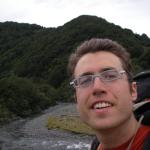
My name is Jacob Hoffman-Andrews. I’m an programmer from San Francisco.
In January-April 2009 I did a through-tramp of the completed portions of the Te
Araroa Trail in the South Island of New Zealand. I started the trail at Bluff in
the south and finished at Ship Cove at the north end of the South Island.
Even though I only updated the blog periodically when I was in town, each blog
entry is written as if on the evening of the day in question, and the posts are
backdated to the relevant day. Hopefully this makes for the most logical flow
of reading.
Please feel free to email me (jsha at newview dot org) if you have any questions about this blog or my hiking experience.
Roxane and began our trip in Auckland, transit point for many a New Zealand tourist. We stayed at a lovely Victorian-hobbit hybrid house named The Verandahs. Victorian because of the high ceilings, hobbit because of the doorknob square in the center of each door.
The first night I was beastly to Roxane, forcing her to stay up to the ungodly hour of ten in the evening so that we could adjust more quickly to the local time zone. I soon regretted this, as the next day I was struck by a cold, or allergies, or something that made me sneeze incessantly all day. Now Rox was the one making me stay awake while my eyelids drooped.
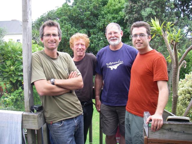
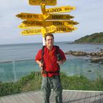
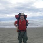
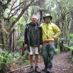
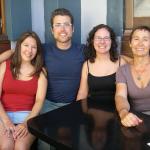
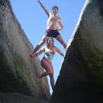
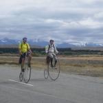
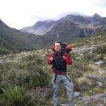
Left to Right: Sheridan, Geoff, Kim, and I
On Saturday I took the ferry to Devonport, Auckland’s Sausalito. There I met up with Geoff Chapple, hatcher of the Te Araroa Trail, Kim Ollivier the TAT map guru, and Sheridan Robinson, a Brit who through-hiked the trail last year. We powwowed over tea and my large overview map. They gave me wonderful up-to-date advice on the current status of the trail, which is still only partially complete. There are large sections where the only alternatives are to ring up a landowner and ask permission to cross their land, or do a long road walk.
I’ve decided that I’m going to walk the trail from South to North, that is, begin at Bluff and end at Cape Reinga. There are two reasons. The first is that I evidently like to do things backwards. When my father and I hiked the Appalachian Trail we did it Southbound. We had a small contingent of co-hikers, but the large majority of through-hikers on the AT start at Springer Mountain in Georgia and head North as the seasons move into summer. When I rode from Boston to San Francisco on my bicycle, I did it against both the prevailing winds and the prevailing current of bicyclists making the trans-America trip. On the Te Araroa Trail evidently most through-trampers start at Cape Reinga, so in keeping with tradition I will go the other way. Geoff tells me there have been a few folks to hike it my way, so I’m not breaking any new ground, but that’s fine by me.
Of course the other reason I chose to go North is that I am starting in the middle of summer and would like to do the southern latitudes first while they’re still warm.
In any case, Roxane and I have our flights this afternoon to Invercargill, where we’ll stay a few days and do some final prep. I can hardly wait!
January 11th, 2009
I passed a sad, anxious, thrilled night in Invercargill with Roxane before setting off. In th morning she was to board the Stray backpacker bus and start her tour of New Zealand, while I started walking. My plan was to leave most of my stuff at the Kackling Kea in Invercargill, hitch to Bluff and walk back as a day hike.
The day started well. I caught a ride from the chaplain of the Tiwai Point aluminium smelter, across the bay from Bluff. Hearing my story, he decided to go the extra distance and be a bit late for work. He dropped me off at Stirling Point, the official beginning end of the trail. I took some nice photos and got on my way along the lovely graded track that leads around Bluff Hill. It was a nice start, and I saw a handful of Paua divers along the track.
Soon I realized that I had made two mistakes in packing my day bag. For clothes I had grabbed the bag that had socks and shirts, but no rain layers. For food, I had grabbed the bag that had dinners but no snacks or lunch. And, somehow I had my tent with me. My meticulous repacking job the night before had almost exactly reversed my intent.
Then, near Foveaux Point, I took a wrong turn and wound up heading to the top of the hill instead of around. By the time I realized my mistake I decided it would be a good chance to improvise. I went over the top into Bluff town, and picked up some food at the local market. This put me on the road only a kilometer or so south of where the official road walking begins according to my information.
I had promised myself a long time ago that since Te Araroa is not yet complete and there are many roadwalks, I would allow myself to skip any roadwalks, since they’re very unpleasant – hot, hard on the feet, and loud. This being my first day, however, I figured I should do it proper and walk the roads. I could start slacking later. This road, Highway 1, was worse than usual though. Bluff is a medium-sized port and offloads many goods to be delivered by truck to the rest of Southland. I had dozens of double-trailered container trucks whizzing past me every hour, giving a hot, foul blast of air on my face.
Greatly dispirited I made it to Stanley Township Road, a small farm road that theoretically leads through to the stopbanks of the local river, from where I could hike off-road to Invercargill. After stopping briefly at a cow shed to ask a couple of fellows there for permission to cross the farm, I set out down the dirt road. At its end I found there was dense gorse and other shrubbery blocking my way. The road curved north, so I followed it and tried several other access points, but none seemed suitable to get my through to the river. At one point I came to a large enough hill that I could see there wasn’t much margin along the river anyhow, so I gave up. This section of the track is not officially formed yet, but I had hoped with some determination I should have been able to make my way through.
I returned, dispirited, to the road. By now it was quite late in the day and I faced a long roadwalk still to get to Invercargill. I decided now was the time to exercise that rule about skipping roads, and stuck out my thumb. Hitchhiking with my left thumb will take some getting used to, like using an underdeveloped muscle for the first time.
I was glad that Roxane and I had befriended Antonia and Peter, the hostel managers, as it helped a lot to have a sympathetic ear when I returned to the hostel.
On the high sides for the day, I found that donning my pack and boots again triggered all sorts of body memories from when I hiked the Appalachian Trail. When my hips were bruised from the waist belt on my pack, it wasn’t just a dull pain, it was a dull pain that reminded me of a great and happy adventure. When my legs were stiff in the morning, I thought of New England mornings creaking my way out of a lean-to and talking about the day’s challenges with my Dad. So even when I had my down moments I was able to say to myself “At last, I’m on a long trail again!”
January 14th, 2009
I had gone to a printer in Invercargill to get some route maps printed, and they were ready this morning. So I set out a little late, waiting for them to open. Nice thing too, since Roxane’s bus was coming back through town from Stewart Island. She texted me and we were able to meet up briefly during their rest break, and say goodbye again. I quickly shunted some of my excess maps onto her, so she could mail them to Queenstown for me.
My lesson of the roadwalks yesterday was evidently not well learned, since today I stubbornly refused to skip the first section again. It was much quieter, not nearly as bad as Highway 1, but still unpleasant. The closer I got to Oreti Beach, though, the quieter the road got, until it was almost peaceful.
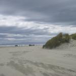
The beach was lovely, sandy, and long. It had nice compacted sand for good walking. Close to the entrance, there were a few cars and people and dogs, but after a couple kilometers it was just me and the waves. It was really a gorgeous walk. I had been warned about a river mouth along the way, and sure enough I got there right at high tide, around five in the afternoon. Fortunately the light lasts until ten oclock right now, so I didn’t mind waiting a bit. I found the top of a high dune and for two hours watched the incoming waves fight against the river current and slowly lose. They made fascinating patterns and eddies that changed based on the pattern of swells coming in.
Once I judged the crossing to be low enough, I took off my trousers to wade across. At the deepest point the water came nearly up to my waist anyhow, so on the other side I took off my now-salty underpants as well, and let my nethers air-dry. The great thing about hiking in a remote area is the options it gives you.
One of the other interesting things I noted near the river mouth was that the sand closer to the river was very soft, almost quick. But closer to the ocean was nice and hard-packed. Whether this was the differing effect of fresh versus salt water, or the compacting action of the waves, I don’t know.
A few hours later, by now fully clothed again, I trolled into Riverton. It was nearly ten by now, and the town was quite closed up. Lucky for me there was a fellow who lived at the backpacker’s just staggering home. He showed me a bed and the kitchen and told me I could pay the owner in the morning. I made a rather poor try at cooking one of my backpacking meals, ate what resulted, and fell sound asleep.
January 15th, 2009
I planned to make a short day of it today, since I wanted a chance to meet up with Kevin Hawkes of the Te Araroa Southland Trust to discuss routes through the Longwoods, and I suspected I’d get hit by rain soon and might want to wait it out in town.
I had noticed the night before that the USB cable for my phone had gone missing. I searched again and it was still lost. I use this cable to charge my phone, and with it I lost not just my calling capabilities, but my GPS and music as well. It had to be replaced, and Colac Bay would not be the place. So I asked the hostel owner, Bruce if there was an electronics or camera shop there in Riverton. He asked what I needed, and discovered he had a spare of the exact cable gathering dust in a drawer. Thanks Bruce!
I’d not been on the road ten minutes when I was stopped by a fellow out walking his dogs. “Where you headed?” he asked. “Cape Reinga!” I replied. He told me he was planning to do the tramp this year too, and invited me up to his house for tea. This fellow, Dene, and I chatted a while about tramping and had a grand old time. Turns out he’s heading Southbound in February with Lloyd Blakie, another person Geoff suggested I contact about Southland routes. We traded contact info with a promise to meet up when our paths cross somewhere in the middle.
I headed on up a beautifully maintained track over Mores Reserve, and down to the coast West of Riverton. The coastal walk from there was unmarked and quite rough. The choice was between rock scramble at the waterline – nearly impossible in some places – and walking with sheep on the bluff above. I was a bit nervous about whether there was permission for trampers to come through up above, as there was no trail, but after a bit of rock scrambling I became convinced that was the only way. The one that that really gave me pause was when I came around a taller-than-usual fence, and where the fence ended at the sea was an old faded sign saying “DON’T ENTER – BIG BULL.” I took it to be out of date, but kept a keen eye on the hill anyway.
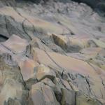
The landscape in this section was really quite nice. Each outcropping of rock seemed to have a different makeup, and all different colors. First was a deep mottled sea-green, then a light blue and purple harbor verging on turqoise. The next one had rusty and ochre rocks crazed with dark cracks. All of them were worn very smooth by the waves, with fantastic shapes and hollows grooved out by wave-tossed rocks.
I arrived at the Colac Bay Backpackers and Tavern “Dustez” around seven for my rendezvous with Kevin. He came by with some maps and GPS coordinates, and as we went over my topo maps, he gave me advice on navigating the Longwoods, and strongly suggested I get a guide to take me through, since a significant section of the route is untracked and very poorly blazed. He’s calling around some folks looking for someone, but failing that I’ll go ahead by myself, going slowly and carefully to not get lost.
January 16th, 2009
I decided to spend a rest day in Colac Bay, both to wait out the rain, and to see if Kevin could find somebody who knew the Longwoods well and was interested in guiding me through. Also, my right ankle was hurting a bit so I could use the rest.
There’s not much to do in this tiny hamlet, so I settled in for a quiet day of reading and journalling. I hadn’t gotten far when a family showed up with three or four very loud, very bored kids. I had a hard time getting an exact count because they never seemed to stand still for very long.
Despite the distraction, it was a rather nice day. I caught up on my journal, went for a little walk along the beach, and watched “Catch Me If You Can” on television.
January 17th, 2009
In the morning I got a ride to the beginning of the Long Hilly Track with a fellow backpacker I met at Dustez. This is the beginning of the Longwoods section of Te Araroa. Kevin’s farm is right nearby, so I had arranged to meet up with him and get a few more bits of information about the route. Kevin was busy moving some sheep though, so while I waited I did a short hike of Long Hilly, which is a loop through historic mining operations.
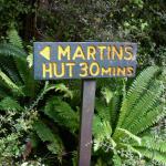
I came back down around ten-thirty, and Kevin gave me a few more GPS coordinates, as well as some more descriptions of key navigation points on the route. I was getting antsy by this point to get on the trail, as I had quite a long day ahead if I meant to reach Martin’s Hut by dark. But meeting up with Kevin proved to be quite useful and important. He walked me back to the top of Long Hilly, describing the history of the area as we walked.
The area we were in at the moment is the site of an old Chinese gold mining operation, and the Port’s Water Race track which I was about to hike follows the course of a miles-long ditch dug to supply water from the opposite side of the mountain for this operation. This is no ordinary ditch, naturally – in order to make the distance it had to be carefully built with an absolute minimum of fall per distance travelled. And in order to carry enough water it was as much as 1.5 meters deep in places. The route I was to follow was actually the old maintenance track used by workers for the mine to keep the water flowing.
The nature of the race meant that the route closely hugged the contour lines of the mountain, dipping inwards and then outwards again at each gully. It also meant that the track was quiet flat the whole way, and relatively easy to follow despite being occasionally overgrown. A few times I lost the track for a moment, but I found I only had to reason about where the race would have gone, and I found it again quickly. The first time this went wrong, I backtracked to the last point I had seen the track and realized that some rotting timbers found there were the remains of a bridge that had once crossed the nearby dip. Sure enough, straight across the gap I found the trail picked up again. Over the course of the day I found several more such bridges, as well as some places where the race tunneled under a hill. It was a fascinating route to follow.
The weather was wet and gloomy all day, with intermittent showers, which dampened my overall enthusiasm to finally be tramping in the woods after a lot of road and beach walking. As the end of the day approached, I figured I was quite close to the hut, but darkness was closing in early because of the clouds so I reluctantly set up camp in the rain. I was happy to have my Hennessy Hammock, because it would have been hard to find open, flat ground near the trail – most of the floor was quite uneven with fallen trees and stumps. However finding two suitable trees to hang from was easy.
Once I got warm and dry inside my sleeping bag, all grumpiness at the conditions outside quickly faded away, and I resolved not to get out of bed until it had stopped raining and the skies were clear.
January 18th, 2009
I was half joking with myself yesterday when I said I wouldn’t get out of bed till it stopped raining, but I spent a long time this morning waiting for a dry spell. None came, so eventually I packed up my hammock in the rain and got moving. I was still about an hour’s walk from Cascade Rd, the end of the Port’s Race track. When I got there I was thrilled to get out from under the trees and have open sky above me, even if it was grey. From Cascade Rd the trail to Martin’s Hut was steep and muddy but well blazed. My ankle was bothering me again so I decided to stop early and spend the night at the hut.
It’s a cute old hut - very old and basic. But it had four walls and a fireplace, which is more advanced than the shelters along the Appalachian Trail. It even had bunks made of chickenwire and burlap. I made a little fire and had a nice evening drying out.
January 19th, 2009
This morning, the rain had mostly stopped and I started out in good spirits. The track from the hut to the summit, though, was quite difficult. It was a river of mud from all the recent rain, and there were many large blowdowns blocking the way. I often had to hunt around to find the trail again after circumventing some obstacle, or after the trail simply disappeared for a few meters. Fortunately, the trail was well blazed. Someone had come through with segments of venetian blind and nailed them to trees along the way. It’s a surprisingly good way to mark the trail – they’re sturdy and quite visible. In places where the blinds were insufficient, often some kind soul had tied a bit of marking tape around a branch or limb as an extra guide. Even so, I frequently found myself off the trail and had to backtrack to find it again. Progress was slow, the rain had started again, and my boots were soaked from the trail.
It was then that I had my first encounter with bush lawyer. This horrible plant seems like the invention of some evil scientist. Imagine a blackberry bush. Now imagine that it has five times as many thorns, including on the bottom of the leaves. Now imagine that instead of a bush, it’s a climbing vine that frequently drapes itself at head height across a trail. Getting tangled up in this stuff feels like being attacked by Audrey II from Little Shop of Horrors, and struggling just gets you more tangled. You have to stop and painstakingly pull away each vine, following the direction of the thorns and hoping it doesn’t get re-stuck after you’ve pulled it away.
So between the bush lawyer and the blowdowns, it was several hours before I reached the top of this relatively short trail section. The sight of the bald on top of the mountain was encouraging, and the sky even cleared up a bit. Unfortunately, on top the trail becomes both overgrown and poorly marked. I later found out that the trail was supposed to die out – with the good visibility on top you can just forge your own path. But at the time it felt like one more failure of navigation. I sat down and started to reconsider my trip through the Longwoods. The section I had just finished was the easy, well-marked bit. It was the section ahead, on the other side of the summit, where Kevin had told me the trail was quite obscure and advised me not to go without a guide. If I had this much trouble navigating the good part of the trail, it was unlikely I would get through the rough patch ahead within my allotted time.
As discretion is the better part of valor, I decided to give up on this section for now and head back down. Going down, of course, was much faster, and by now I recognized much of the trail. I spent another night at Martin’s Hut and pored over my maps. Declaring defeat here meant that I was giving up on the whole Longwood range. North of that was the Island Bush block, which was navigable but very short (5 kms). Beyond that is the Woodlaw block, which is a decent hike but evidently there are still permissions issues to be worked out so I couldn’t really go through there. The next section north is the Takitimu Mountains, the southern half of which is also blocked by permissions issues. There was quite a long chunk of trail that I was just going to be skipping.
I began to get quite discouraged about the entire trek. What if the whole trail was as difficult as this? What if I kept having to circumvent impermissible sections? What if it rained the whole time? I resolved not to give up yet, but I was at a pretty low point. Looking at the maps I decided that I would try to get the necessary permissions to do the Takitimus so I wouldn’t be skipping as much. I would get up early the next morning, head into town and resupply, then head right out again. With at least the nugget of a plan, I was a bit happier about my prospects, but still frustrated.
January 20th, 2009
The weather had finally changed for the better this morning, and it was in a good mood that I descended back to Cascade Rd, a gravel access road I walked down to the Pourakino Valley. I had expected to get a ride into town with relative ease once I was in the valley, but it was a quiet farm road with hardly any traffic. I had to walk the 8 km or so out to the bottom of the valley before I found a slightly less-quiet road and a ride. Even then, I was passed up by several cars until it started raining and a kindly old farmer gave me a ride into Riverton.
I planned to get food and hitch up to Otautau to stay the night, so I’d be closer to Ohai, where I would enter the Takitimus in the morning. However, after waiting a long time on the Riverton-Otautau road, it was clear there was little traffic and even less interest in picking me up, so I stayed the night at a backpacker’s in Riverton. A good thing, too, as it turned out, since I had a chance to call the station whose land I wanted to cross and find that they weren’t the least bit interested in giving me permission to come through. From what I’ve heard and seen so far, New Zealanders are quite particular about their property rights, although some folks tell me this is a recent development in the last five or so years, in response to a wave of litigation by people injured while crossing someone else’s land.
January 21st, 2009
The lack of a route through into the Takitimus meant that I couldn’t access the Takitimus from Ohai, so I had to go far around to Mossburn and come in along the Aparima river. This meant hitching all the way back to Invercargill to get on the main highway going north, then back west again. My first hitch came pretty quickly - a nice young couple. They took me all the way to Invercargill and dropped me off right where route 6 headed North. I then waited two hours fruitlessly, trying various combinations of pack on, pack off, sitting, standing, left thumb or right thumb. Hundreds of cars passed me. After all that time, the simple idea occurred to me that I should move maybe a hundred meters closer to the interchange, before people picked up speed. Success! This ride took me to Winton, where I got stuck waiting for yet another ride. By five or so I decided it was too late to get the three rides I probably still needed – one to Lumsden, one to Mossburn, then one out onto the country roads as close to Aparima as I could get. So I bought a room at one of the local pubs and met a tour operator and a farm manager over beers. They had been trying unsuccessfully to fix the gearbox on the one guy’s truck, and had come to get drunk before having another go at it, in hopes the beer would unlock some previously unknown mechanical trickery.
January 22nd, 2009
I got out on the road early, hoping to catch some commuter traffic. I had shaved the night before, on the hypothesis that my facial hair might have been the reason I was having so much trouble hitching. I wound up waiting about an hour, and the guy who picked me up said “I picked you up because I saw you on the way into town, and that was a while ago, so I know you’ve been out here a while.” He was an old navy man who had tried retirement, found it didn’t agree with him, and was now a cook at a pub. He gave me an absolutely fantastic ride, all the way to the base of Dunrobin Road, which was the one I needed to hike up to get access to the Aparima River.
It was warm, overcast, and most of all dry, so I had a pretty good time walking up this gravel farm road. There was a ferocious and continual crosswind that made me quite glad my hat has a strap underneath it. I got to the Aparima River and, misreading the map, thought I had to cross the river. I carefully took off my boots and rolled up my pants before wading across. After walking on the other side for a bit, I realized I had to cross back, and did my meticulous unshoeing act again. This carefulness about wet feet would not last long.
As I walked up the river valley, the sky cleared up even more, and the wind eased up a bit. It’s beautiful terrain in here, a big flat plain with great mountains on either side. I was thrilled to have such great tramping and weather finally. I thought “This is it – this is what I’ve come out here for.”
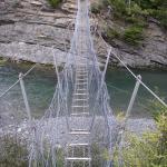
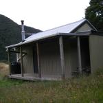
Towards the end of the day I crossed my first swingbridge to the Aparima Huts. There are actually two huts here - an older one and a newer one. After cooking my dinner and reading the logbook in the newer one, I went to take a look at the old one. I found I liked it much better! The insides of the new hut, like many DoC huts evidently, is coated in particleboard and painted white. The older hut is plain wood, with fabric in places to provide additional insulation, and a tin roof. It feels much more rustic and has a lot more character. I found I liked the older one much better and wound up moving in there for the night. The larger stock of books in this one may have had something to do with the decision – I found half of a book of Arthur C. Clarke short stories.
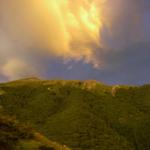
I remained inside the hut for a while, and went outside to brush my teeth as the light started to fade, and was treated to an amazing golden-coloured countryside. The setting sun was reflecting off the bottoms of the high clouds and giving the landscape a shadowless glow not normally associated with sunset. It was a great end to a great day.
January 23rd, 2009
From the hut, it was another day of mostly river walking. The first half of the day, there was a nice 4WD track that gave me solid ground and a track to follow. This is Waterloo Station land, and I was walking with a number of cows. As I came close, they would get nervous and run away, but the only way they could run was further up the valley - the same direction I was headed. It was amusing at first, but soon got annoying. At one river bend I managed to carefully navigate around them on the far side without spooking them, finally putting the cows behind me after several hours.
The chief obstacles on today’s walk were bog, whenever I ventured far from the river, and cow pies. The terrain was relatively easy, but I soon found it was easier to walk on the banks of the river. I also quickly got over my aversion to getting my boots wet, as I was crossing the river so many times it wasn’t feasible to keep taking them off. The day was rather hot, so it was even a bit pleasurable to have the cold water on my feet.
I had another really excellent hiking day, but a long one. DoC estimates it takes 2 hours from Aparima Huts to Beckett’s Hut, and then another three to Princhester Hut. It wound up taking me twice that for each leg. Sure, I spent many long breaks daydreaming and lollygagging, but I didn’t think they were so long as to double the estimated time. Maybe it’s unfamiliarity with the country, or maybe I’m out of shape.
When I got to Princhester Hut, I met a pair of guys out on a weekend hunting trip. They fed me beers and were a great source of information about some of the flora (and relatively little fauna) I had encountered during the day. In the morning they will give me a ride into Te Anau so I can resupply for the next leg.
January 24th, 2009
In the morning, caught a ride from the hunters down into Te Anau. Originally I had planned to make it to Queenstown in seven days from the Aparima River, but I had skipped a section in my planning so I was three days short of food. I intended this to be a quick in-and-out mission, resupply and get back on the trail with enough time to make some more progress. But a raincloud was rolling through, and I figured I might as well camp out in an Internet cafe until it passed.
Once the rain was done, I hoofed it to the edge of town and started thumbing. My luck has improved. Within half an hour, a Czech businessman picked me up. He had spent seventeen years building a business that made schwag (small logoed gifts given freely as advertisement) and sold it. Now he was traveling and learning English in Christchurch.
Once I arrived on the trail, my notes and map indicated that the flats of the nearby Mararoa River would make an easy hike. There was an angler’s access giving me passage through a field, so I headed down it to reach the river. I soon came to a crossing with a tributary stream. Reveling in my newfound nonchalance about water crossings, I thought “I’ll just tromp along in the water here till it hits the main river.” Sensible enough, but this tributary started taking me further and further downstream, when I was meant to be going upstream. One shortcut later, I had found the river proper, but found its banks covered with waist-high tussock, ankle-deep mud, and the odd gorse patch. There were nice shale patches in the bed of the river, but this would have required constant recrossings to keep up with the fluvial wiggles, and it was just deep enough that I wasn’t comfortable. I struggled along the banks for a while before giving up and heading back up towards the farm land – maybe there was a clearer way through there. Another bout of gorse fighting led me back up onto dry grass… twenty meters from where I’d started.
By then I was knackered, and I found a gorgeous tree whose multiple trunks spread so wide there was just the right amount of room in the center to hang my camping hammock. Otherwise the area was open, with views to the river. It felt like the perfect campsite.
During my exploits down at the river, I had my first encounter with didymo. Also known as ‘rock snot’, it’s a foreign alga that’s been choking New Zealand’s rivers and turning DoC red in the face. I’d seen any number of pamphlets and warnings about how not to spread it from one river to the next, so it was interesting to see it in person. Unlike many invasive species, which seem harmless to the uneducated eye, this stuff is visually repulsive. It forms a green mat of goobers across the river bottom, and in places where it’s been stranded above water, it looks exactly like dried-up sewage. Consider me convinced – I’ll certainly do my best not to spread it.
For what it’s worth, the hunters I met last night blame DoC for indecision. Evidently it was first discovered in a single river, and they could have stopped it there by dumping in a truckload of salt, killing everything. The theory goes that the native ecosystem would have regenerated over time, but the invasion of didymo would have been stopped. It’s obvious why DoC would have hesitated to implement such a drastic solution, but it does seem like their current efforts at containment are doomed to fail, since it requires less than a drop of water to spread the infection from one river to the next.
January 25th, 2009
From my lovely nest in the broad tree, I set out again along the grass verge of the river, following the edge of a farm fence. I only made decent progress for about an hour until the gorse started to close in on me. After some debate, I hopped a fence and crossed an empty field to the nearby metalled (gravelled) Mavora Lakes road - an easier, if less scenic, way to get where I was going.
The road was hot and dusty, and I tried a couple times to get back on the river, but it was too frustrating. Just when I would start making progress, the river would meander into a tall embankment, forcing me back onto the road. I did meet a handful of cycle tourists on the road, which was nice. Seems like most cycle touring here happens on the metalled roads, since the sealed (paved) roads generally have no shoulder and plenty of mad drivers.
Overall an uneventful day, walking among miles of sheep farms to another spot on the river where I made camp.
January 26th, 2009
Woke early to take advantage of the early morning chill. It was so chilly in fact, I started the hiking day wearing my fleece, vest, and raincoat. The weather continued to be overcast most of the day though, resulting in very pleasant hiking weather once I warmed up.
I soon reached an intersection where the Mavora Lakes Road departed north (oh how I despised that easy but dull causeway by now) while a DoC trail crossed on a swingbridge and continued on the true right of the Mararoa River, then around South Mavora Lake. True right or left in Kiwi parlance is the direction determined as facing downstream, a very useful idiom for anyone navigating near a river.
The trail I found myself on was gorgeous - the best trail I have been on so far. The track was clear, it was well marked, and it traversed a lovely beech forest with a mossy ground cover. It also followed the river, by now far from any farming activity. I took a break at the top of a mossy embankment overlooking a slow bend in the Mararoa. It was exteremely silent and peaceful, and I loved it.
At times, the silence in this section of trail was eerie. There was nothing but the occasional sound of the river rushing through a tight spot, or a muted car on the distant road. Much of this can be chalked up to New Zealand’s paucity of animals. When New Zealand parted ways with Gondwanaland some 80 million years ago, it began a process of evolution isolated from the rest of the world. The result was the giraffe-like giant moa (now extinct), the saccharine-cute kiwi, and in general an ecosystem where most niches were filled by birds, often flightless ones.
In more recent times, certain thumbed mammals contrived transport to this ark of birdlife. With the Maori came the Polynesian dog and Polynesian rat, with a taste for those easy to catch birds and their eggs. The Maori themselves had a powerful hunger for the moa, especially since their crops mostly failed to grow here. Later, Europeans brought the Norway rat, the even more pernicious ship rat, and the dog. After that was a plague of rabbits that started eating all the carefully cultivated European crops. So weasels, stoats, and ferrets were introduced. Unsurprisingly these too quickly bred out of control, and they are now one of the biggest threats to native birds.
This all adds up to an ecosystem with most of its land animals gone. Eerie indeed. The plantlife seems to flourish anyhow, unaware of its loneliness. For me as a hiker accustomed to spotting cute mammals everywhere, it’s odd. Evidently there is an oversupply of deer, but I haven’t even seen one of those, while in parkland in the States, you couldn’t swing a dead possum without hitting a deer.
Still, I greatly enjoyed the trail, and had it to myself till I recrossed the Mararoa to the North Mavora Lakes Campground. This campground is accessible by road, so I had several holidaymakers for company, but it was a decent spot, so I made camp for the night.
I took advantage of the handy firepit to keep warm while I cooked dinner. When I hiked the Appalachian Trail, I never had energy at the end of the day to build a fire, but here I’ve done it several times, largely because it’s so easy. The huts and campgrounds here have ridiculous amounts of unused deadwood lying around within spitting distance. Perhaps it’s because they see less traffic, but an equivalent campground in the States would have long been stripped of all burnable material. Also, I learned a great trick from the hunters at Princhester Hut: dead beech branches with the leaves still on light easily, and they burn hot and fast, making them ideal fire starters.
All in all, today was a fantastic day, one that made me think “This is what I came here for.” The only two lowlights: I’ve developed a painful pinch on my left hip when my packbelt sits just so. I’m trying to figure what it is, but it’s confusing – there’s no assymetry in my pack or clothes that should cause a problem only on one hip. Second, the battery on my camera finally ran out, leaving me unable to take photos until I pick up the package with my charger in Queenstown. [I would especially regret this, as the next few days turn out to be some of the best scenery so far.]
January 27th, 2009
Spent a chilly night in the hammock because I was positioned in it wrong, with my feet higher than my head and receiving insufficient blood flow. I also had the bottom closure wedged open for a while, letting in cold air. As a result, got out of bed and on the road as soon as the sun broke the nearby mountains.
The first hours of my walk were on a four-wheel drive track bordering North Mavora Lake. The track was slightly dull, but with the lake on one side it was more pleasant than the road walking from two days ago. I was passed by a family riding the trail on mountain bikes, and a pair of motorbikes. At one point I spotted a little golden tube of fur bounding out of the grass. It hopped out onto the road and stared at me for a minute – either a stoat or a ferret, but either way it was quite unafraid. When I stepped closer it scampered off in front of me, then down some hole. My excitement at finally seeing a cute mammal fought with an abstract fist-shaking at this harmful, invasive species. It was a busy day for animals – later on I spooked a pair of rabbits.
Just before I reached the head of the lake, it had gotten quite warm, so I stopped for lunch and jumped in the lake. It was cold, but my swimming in the San Francisco Bay has adjusted my parameters for what is acceptable, and I quite enjoyed a trip out into the lake and back to the shore, where I lay for a while and soaked up a few of New Zealand’s hyper-powered sunrays. The ultraviolet index is part of the regular forecast here, and their scale goes to eleven – literally.
Soon after lunch I was at Boundary Hut, built at the spot where DoC land ends and Ngai Tahu station land begins. The trail continues through their land with permission, and even has a hut inside it, but for some reason it was considered useful to have on right on the edge. I had the classic through-tramper’s choice. It’s still early, and the next hut is 4-5 hours away. Do I settle for what I’ve got, or push it to the next hut and risk getting caught out in the dark. I’d been making great progress, so I figured it’d be a cinch to get to Taipo Hut before dark.
Pretty soon I realized my mistake. Boundary Hut was a natural inflection point in the trail, because from there on the track standard fell significantly. It was still well marked with orange-topped waratah standards, but the trail underfoot became fainter and more boggy. My pace slowed quite a bit, and I found myself pushing hard against the sun and my own fatigue. I made it to Taipo Hut just as the light was getting low enough to make spotting the next marker difficult.
Inside I found a young Danish couple, out on the second day of a fishing and tramping trip. For the girl it was her first tramp, and the guy had done only a few before. They were having a bit of a rough time of it, and were quite glad to see some human company for the first time. They had their jetboil-style stove running nonstop for a surprisingly long time, and when I asked them what they were cooking, they said “Oh we already ate, now we are boiling our water for tomorrow.” Despite the standard advice to “boil or treat” your water, I had never before actually seen someone boiling water on a tramping trip. The costs in extra fuel weight are generally prohibitive, not to mention the hours they spent boiling a pot at a time, waiting for it to cool, and then pouring it into their plastic water bottles. I suggested to them they might try an easier chemical treatment technique like iodine or chlorine, although I have actually been drinking most of my water on this trip without treatment, since New Zealand streams are generally quite clean. I’ve only been treating my water when I am obliged to take water from a river or a stream that passes through stock land.
January 28th, 2009
In the morning it was raining, so the Danish couple and I lingered over breakfast a bit longer than usual. Eventually I bid them goodbye, having figured that I was well ahead of schedule by now and I might as well see if I could out-wait the rain. I had a good book, plenty of food, and some well-thumbed copies of FHM, Wilderness, and Reader’s Digest left in the hut.
Hours later, I was pacing the hut and it was still drizzling. I decided that this rain aversion was ridiculous and set out. It really wasn’t that bad once I got out in it. The landscape was much like yesterday, plenty of bog and tussock. This section of trail was well marked in that I could always find the next waratah standard, but I noticed a distinct economy on the part of whoever marked the track. Standing at one pole, I could always see the next pole – but just barely. If there was a slight rise, for instance, the next pole would be placed so that only the orange top peeked above the hill. Often I would pass a few feet from a waratah standard and be unable to see the next one, so I would have to walk over and stand exactly next to it – and invariably I would spy a tiny cylinder of orange in the distance. As near as I can figure, there must have been two DoC workers leapfrogging each other, one standing at a previous pole and the other walking away and asking “Can you see me now? How about now? Good.”
When the trail turned into the woods to cross a saddle, I was quite glad. Walking through the moss and bog was tiring. The woods to Pass Burn were quite nice. Pass Burn, naturally, originates in the pass between the Mararoa Valley and the Greenstone Valley. I turned a corner, and the path broke out of the woods to a view across a steep ravine to a beech-clad mountain across the way. There was a huge rock slip near the treeline that had cleared out a patch of forest nearly 200 meters high, and still had a couple of half-fallen trees wedged at its bottom. I thought “Glad I wasn’t there when that happened.”
Before I knew it I spied Greenstone Hut through the trees. This is a twenty-bed hut, the biggest by far I’ve been in. Taipo Hut had four beds, and Martin’s only two. It was about three-quarters full by the time dinner was over, with trampers of many nationalities coming off the Greenstone-Caples loop, and some connecting from the Routeburn Track, one of the Great Walks. In particular I met a Dutch couple just finishing a year-long trip similar to Roxane’s and mine. They were quite keen trampers, and are visiting San Francisco at the tail end of their trip, so I made a list of all the day hikes they should do and places they should go. “Whoa,” they told me, “we only have two days there!” Generally had a much nicer time than I expected at such a crowded hut, and slept well. Except that in the middle of the night I woke and discovered that a tightly closed room with ten warm bodies in it gets stuffy quite fast. I cracked the door and it cooled off. At least I know DoC builds well – no drafts!
January 29th, 2009
The first leg of today’s hike went great guns. I had tons of energy and the Greenstone Track where I joined it to descend to Lake Wakatipu was broad and easy. The DoC documents describing the various standards of track building distinguish a “cut” track from one that’s “cut and benched.” I had assumed they meant there were benches along the route, but on today’s track I saw what it really means – if a benched trail goes around a hill, the trail builders chop into the hill a little bit so that the trail provides a level surface.
Along the way I met a couple of very friendly birds. One, a black robin, I had seen before. His dead ringer, anyhow. The other was a fantail, and despite the fact I had never heard a fantail described, I instantly recognized this bird by name. He had a black and white tail about as long as his body, and as he sat on a branch staring at me, he would flick it back and forth rapidly like a dancer flipping a Chinese fan. Both of them flitted about me attentively while I ate my snack. I enjoyed thinking of them as friends, but later a DoC worker in Queenstown informed me that the birds were simply chasing the bugs I stirred up in passing. How they knew I was a programmer, I have no idea.
I arrived at the bottom of the trail around one, with plenty of time for lunch before the bus-boat-bus shuttle arrived to take me to Glenorchy. This may sound like cheating, but it’s the official route - there’s no other good way to cross the Dart River or Lake Wakatipu nearby. The water taxi dropped me in Glenorchy, 48 km north of Queenstown, where I had a choice. I could pay another thirty dollars for a bus to Queenstown, or I could walk there along the road. The road is meant to be quite scenic, and I was several days ahead of schedule to meet Roxane in Queenstown anyhow, so I chose the walk. Now I had a second choice – I couldn’t make it all the way to Queenstown today, and there was no clear camping along the way. Should I pay fifteen dollars to camp at the holiday park in Glenorchy, or get a headstart on the walk and trust I’d find something? After brooding and pacing a bit, I looked again at the map I’d got from the info center. Evidently there is a newly opened conservation area just fifteen minutes’ walk south of Glenorchy, and it has huts – only three or four hours walk to get to them! I wasn’t keen on spending money to stay at the holiday park, with its noisy children and diesel generators. So Whakaari was an easy choice.
This park is centered around old scheelite mines that used to be quite active in the area. Scheelite (calcium tungstate) is used in light bulbs and artillery barrels. The track from the road headed straight into the hills to tour the old workings and mine entrances. I’d just been grousing that Te Araroa has led me mostly through flat river valleys so far. I was keen to do some heavy breathing, and not just because it had been three weeks since I last saw Roxane. This track provided exactly what I wanted, a continuous steep climb that had me huffing and puffing in no time. Soon I was high up the side of a ridge, with fabulous views of Lake Wakatipu, the Dart River, and the Greenstone track I had just come from. I rounded a bend and had a view across to the neighboring mountain, with old mining tracks zigging across its face.
After a couple hours I was ready for a break, but unfortunately the trail wasn’t. I still had at least an hour of climbing to reach the Heather Jock Hut where I planned to spend the night. By this point my quadriceps were twanging like a badly tuned piano, and I stumbled a few times – worryingly given the steep terrain. I thought “This was a stupid way to save fifteen bucks.”
I reached the Bonnie Jean Hut, an old miner’s hut set up with a historic display inside, and steel bars to prevent sleepy trampers from trying to stay there. It was getting windy and overcast. I ate a candy bar for energy to finish the last stretch to the overnight hut, and set off. Found one marker, couldn’t find the next – oops, there it is, ninety degrees to the right of the trail, with no trace of a path running to it. Scrambled up there, and… nothing! I dropped my pack and scouted around a bit, but there was no next marker in sight. I could push on anyhow in the indicated direction and hope to pick up the trail again, or I could give up. I stared for a minute at the sun, quite close to the ridgeline by now, and turned to go back down. I definitely did not want to get lost on top of this mountain in the dark.
Bonnie Jean Hut wasn’t an option. The mountain sides were completely devoid of trees – they had long been cleared for use as goat pasture. But about an hour back down the mountain was a turnoff towards another day-use hut that looked wooded, so I went back down there. When I arrived, I was especially glad to have my hammock, since there weren’t many sheltered flat spots, but there were plenty of trees. Setting up the hammock on a slope is no problem, so I set about making camp. The only tricky bit was that I had to tension the rainfly very tight, because strong winds were whipping up from the east, and would set the rainfly flapping noisily if I didn’t tie it well. After a couple rounds of adjustments – setting up my hammock has become a rather pleasing evening ritual – I got it to hold tight and flat. I expected it’d be a cold night since I was still rather high up, so I wore my hat and clothes to bed. I fell asleep warm and happy.
Tomorrow would be a long day…
January 30th, 2009
My plan was to do the whole trek from Whakaari to Queenstown in one day. Fourty-eight kilometers, that’s not much more than a marathon right? And I have all day to do it, so it should be fine.
I tried to get out of bed early, but was too comfy in among the trees. The section downhill back to the carpark was quite cruisy, but I still didn’t get on the road proper until ten in the morning. It was gorgeous tramping weather, slightly overcast and cool. The road wasn’t too busy, and the views were wonderful as promised. I made good progress, alternating between the road surface and the grassy verge. Stopped for lunch at a pullout by the beach, and ate at a picnic table so crooked and far from the road access that it looked like it had been tossed up by the tide. Met a friendly Queenstown kayaker and his friend, chatted and skipped stones for a while.
I was making fast progress with no obstacles to navigate, but by the time I hit the thirty-five kilometer mark, I was fading. It was past seven, there was no good camping in sight, and it was starting to drizzle. I swallowed my pride and stuck out my thumb.
The very first car to pass picked me up up – a caravan containing an Aussie and his English girlfriend, across briefly from Australia so she could get a new visa. They informed me I was just a couple kilometers shy of a camping area, but by now I was committed to the plan of staying indoors tonight, so I had them take me the rest of the way into town.
When we rolled into Queenstown, I was overwhelmed even before we got out of the car. It was Saturday night, the rain had cleared up, and there were backpackers everywhere. Drinking in the park, sitting on the public stairs, wandering the streets. To go from seven days of near-solitude to this spectacle was a bit much, so I quickly left the town center and started searching for a hostel. Unfortunately, all of them seemed to be closing down just as I arrived. In the end, I settled for camping in the holiday park at the top of town, even though they had no trees of a suitable size. As I was struggling to set up my hammock bivy-style on the ground for the first time, a quiet Israeli camped nearby came over and offered me a beer and a spare tent. He brought his own tent to New Zealand, but the previous owners of his car gave him their cheapo tent as a freebie. We chatted for a while - a nice antidote to the huge crowds – then I went to sleep early. Listening to the rain start up again, I was glad not to be dependent on my dubious hammock skills to stay dry tonight.
January 31st, 2009
The next morning I woke long before the great majority of my holiday park compatriots, had a shower, charged my phone, ate breakfast, and packed up my gear. Leaving the tent with a thank-you note for the Israeli, I headed off into town to do my errands. Got some really useful advice on the Motatapu track at the local DoC office, window-shopped the outdoor stores, and called home. I found that I still didn’t feel properly adjusted to town, and I still had the itch to walk. Many of my errands were dependant on collecting my packages at the Post Shop which is closed today, and I had three days to wait for my scheduled rendezvous with Roxane.
So I set out walking north, to close up the gap I had skipped yesterday. Evidently the section I skipped was just getting into an area where there were quite a few tracks I could use to bypass the road. This was approximately half true. I still spent quite some time on the road, but also had some really beautiful tracks only a few meters from it, where the trees closed in thick enough you couldn’t hear the traffic.
I passed through Seven Mile Reserve, a branching network of trails through which my path was tightly constrained by signs reading “No entry – Mountain bike trails.” Came to Twelve Mile Delta, the first camping site available on the road out of Queenstown. Saw campervans and kept hiking, feeling exquisitely antisocial. The end of the day brought me to Bob’s Cove and a fork – one leading up to the top of a knob and probably a view, the other leading down to the beach and probably camping. I really had no choice – I went up. Soon I found a lovely flat spot, just about five feet eleven inches long by maybe two feet wide. The weather report called for fine weather the next four days, so I set up to “cowboy camp” for the first time on this trip. Cowboy camping is when you skip the tent and simply roll out your sleeping bag with nothing over your head but the stars and a cloud of sandflies.
As the stars switched on, I realized this was the first time I had watched the stars in New Zealand, and it made me realize for the first time that I am in a place far far away from home. There was Orion, but instead of dangling from his belt, his sword stuck straight up to poke him in the belly. There was the Southern Cross, a well-known constellation I had never seen before. No, that’s not it. Must be the one next to it. Wait, there’s that big one that sort of looks like a cross? I never did figure out any of the southern constellations for sure.
In the middle of the night I woke in minor panic. The bundle of clothes I had been using a pillow – had it rolled down the hill and into the lake? I put on my glasses and found, of course, that it had just slipped a little from under my head. And then I looked up and saw the Milky Way in full glory. The sky was so clear and dark that I could make out individual stars in the Way. Even in the high desert of Nevada, I had never seen it as more than a bright smear. The three-dimensionality of the galaxy stood out dramatically, with larger, brighter stars in the foreground fading to a multitude of distinct but dim background stars. And the relative emptiness of the sky beyond the galactic plane was quite obvious too. Staring at the unrecognized and the inverted constellations had made me feel out of place, but the Milky Way brought me right back home.
February 1st, 2009
Woke at sunrise to a birdcall I hadn’t heard before, very synth-y and rhythmic, following a progression of five beats or so. As Roxane has also noticed, many of the birds here sound like backup singers for Daft Punk.
Walked out to the road and was trying to hitch back to Queenstown when an Indian family headed out of town pulled over, asking if they were on the road to Milford. I told them emphatically no, and the young guy who was driving got out so I could show him my map and he could show me his navigation system, which was instructing him to go this way. It turned out that his nav was instructing him to take a series of rather gnarly 4WD drive roads to get across to Mavora Lakes Road, and from there to Te Anau and Milford. I checked the brand on the device: Where2, Google Maps’ big competitor in Australia. I told him he’d have much better luck driving his caravan on the main highway, back through Queenstown in the other direction. And if he’s going that way anyhow, could he give me a ride?
I booked into the Alpine Lodge, a hostel Roxane had recommended to me, and very quickly disliked it, finding the staff unpleasant. It would do for the next couple days, but I resolved to stay elsewhere the day Roxane arrived.
Today was my proper rest day – I really did almost nothing. I wandered in the park, ate Indian food, and generally lollygagged, dilly-dallied, and loitered about town.
February 2nd, 2009
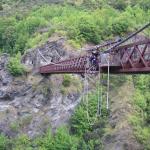
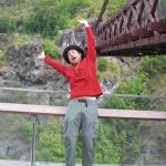
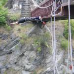
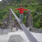
After only a couple of days in town, I’ve succumbed to the constant bombardment with advertisements for tourist activities: I booked a bungee jump.
So this morning at nine I boarded a bus to take me to the Kawarau River. Behind me was an older North Carolina couple – we chatted about the Appalachian Trail. Next to me was a nice young Scottish woman who was inexplicably terrified for the jump. She’d done skydiving, hang-gliding, everything – and hadn’t been afraid like this until she went bungee jumping. I agreed that when the time came I would shout encouragement to coax her off the ledge.
At the bridge they weighed us, tagged our hands, and then it was onto the ledge. I was surprised by the simplicity of their basic apparatus. They wrapped my ankles tightly with a folded towel, then wrapped a strap four ways around it. It was comfy and secure. It was backed up by a standard climbing harness attached to another strap, though I would be falling upside-down so I wasn’t sure what good this would do.
Soon it was my turn. After shouting at my new friend to jump, I could hardly hesitate here myself. I thought back to Cornell and jumping into Beebe Lake: don’t look down, just jump over the edge. It was over almost too quickly – I remember screaming, and then I was bobbing gently at the end of my line, two men in a raft holding out a white pole for me to grab so they could pull me in. I had asked the guy at the top to adjust the rope so I’d get dunked, but my hands just barely touched water. These things are tricky – I had probably jumped too far out from the ledge.
I was back in Queenstown by noon, and still looking for something to do. So I rented a mountain bike and rode out to Seven Mile Reserve, where I’d been walking yesterday. I’ve never done any technical mountain biking before, so I figured I would start out on the beginner’s loop marked in green, and hopefully graduate to blues before the end of the day.
I was wrong. The beginner course kicked my butt. I was skidding all over the place, and frequently lost momentum on the climbs and had to get off and push. After a few loops around it, I was exhausted, and had started getting worse rather than better. Time to head home. But first, there was a long blue route that would take me to the car park, and past another green on the way. I gave it a go. The blue route was loads of fun! It was actually much easier than the green one, because constant use had swept away all the pine needles from the track, and the sharper turns were banked. There was some rolling terrain that could have been taken as a series of jumps if I was feeling braver, but I did try one of the log rides successfully. Great ending to a fun but challenging day.
February 3rd, 2009
Finally, today was the day Roxane was arriving. I hurried around town to finish all the errands I hadn’t got to yet. I checked into the Butterfli Lodge, a much nicer hostel out of town a little way. Rox arrived around three in the afternoon. We went for a walk about town. I had missed one errand – at the grocery store I had found texturized vegetable protein, an important staple from my Appalachian Trail days. Dad and I used to throw it in nearly every meal to add a bit of protein and texture. It’s not common, so after buying a single package of it, I resolved to go back and buy three more to stick in my bounce box. A bounce box, by the way, is a package you repeatedly mail to your future, elsewhere self. It “bounces” from town to town ahead of you. It’s a great way to deal with stuff you don’t need at the moment but will need in the future.
After that, we went for a huge dinner at Fergburger. Rox’s first comment out of the bus was that I had lost a shocking amount of weight and I needed to eat more. So I stuffed myself silly off my meal and her leftovers. Like I needed any incentive.
While there, we ran into two of Roxane’s closest friends from the backpacker bus – Nola and Allison. Had a great time eating with them, then went to the backpacker bar nearby to meet up with the rest of her bus crew. Nola remarked “I’m so surprised – he’s actually sociable! I expected a Grizzly Adams type.” I joked back “The only way I manage it is through prolonged periods of absolute solitude.”
Had a great evening. The best part, naturally, was having Roxane’s company again.
February 4th, 2009
Today Roxane is flying to Auckland, and I’m getting back on the trail. There’s currently no open track between Queenstown and Arrowtown, and I’ve had enough road walking by now to last me a while. So I decided to take the Connectabus to Arrowtown, from where I get on the Big Hill track to Macetown, an ex-town in the hills that used to be a mining center and is now a historic reserve. Luckily, this bus is also the one that goes to the airport, so Rox and I could have some extra time together. One small problem: I still had to mail my bounce box! So I rushed off while Roxane waited for the bus, got my package mailed, and managed to run back in time to catch the bus at a later stop in town.
Roxane got off first, so we said our sad goodbyes. I stayed on, and before I knew it, I was in Arrowtown getting back on the trail. Big Hill was as promised, with great views at the top. I descended the other side to a 4WD track and was soon in Macetown setting up camp early. It’s a lovely place to camp - plenty of mature trees to hang my hammock, and a view of the river.
I was a bit dismayed when a couple of trucks pulled up – I would no longer have the spot to myself. But there was plenty of room, and one of the newcomers walked over to introduce himself and chat. They’re part of a local tramping club, and would be hiking the Motatapu in the same direction as me. I thought to myself, “I just put in all this people time in Queenstown - I was looking forward to a bit of solitude again!” I felt like I should walk over and meet the rest of their crew, but the sandflies were bad, so I holed up in my hammock and read a book the rest of the night.
One thing I was quite excited about today: my camera, which was dead, got a full charge in Queenstown, so I’ve been playing with it a lot. I figured out how to use the manual focus mode to take macro photos as close as 1 cm from my subject! Most point-and-shoot cameras can’t do that. So I spent a good part of the day taking excessive numbers of flower photos.
February 5th, 2009
Today I set out on the Motatapu track. This track has some local notoriety in New Zealand. It was built recently, as a result of negotiations between the New Zealand government and Shania Twain. Shania wanted to buy a large tract of land, the Motatapu station. The government said that in order to buy this land, as a foreigner, they wanted to require her to build a publicly accessible tramping track across it. This happened to connect an important gap in the nascent Te Araroa Trail. In 2006 the track was completed, along with three beautiful new huts. The farmhands down at the station are evidently quite vigilant about keeping trampers on the track – I’ve heard several stories of trampers who wandered off of the tops to take the easy-looking river route down below, only to be intercepted and told to walk right back up to the track.
Before I reached the Motatapu Valley, though, I had to get up to and over Roses Saddle. A sign at the trailhead indicated I could walk along the Arrow River most of the way, saving time and effort versus the marked route, which sidled up and down a series of hills. The river route sounded appealing, but I was worried I would miss the turnoff, where the marked route left the river. So I followed the markers, figuring I would spend a bit of extra effort but couldn’t get lost. It was a lovely day, and not too long – I rolled in to Roses Hut around three in the afternoon. There, sure enough, was the group that had camped with me at Macetown the previous night. I was bracing myself to be sociable, but when I opened the door my first greeting, from an older woman, was “You were still asleep in that hammock when we left this morning!” As if she was surprised I ever got out of bed and started hiking. Everyone else in the group was quite nice and considerate, but this introduction quite put me off, so I whiled away most of the evening out on the porch reading my book.
Reading the hut book was fun, because it went all the way back to the opening of the trail in 2006, including an entry from Geoff Chapple as part of the crew leading the pre-opening day hiking to check out the trail for Te Araroa. There was also an entry a few days later from the Roses family, mentioning that an ancestor had once hiked this area, and the hut was named after them!
February 6th, 2009
Te Araroa has occasionally been said to have not enough ridge walks. Certainly as a tramper coming from the States I notice this lack. On the Appalachian Trail I quite enjoyed the challenge of climbing a ridge, and the reward of views up top for the next few hours. New Zealand’s existing trail networks don’t match this style very well, though. Most of the through trails seem to traverse a river valley, crossing to the next valley at the most economic place possible – a pass or saddle. The trails that go to the top of a mountain are generally return trails, with the assumption the user will come back down the same way they went up. The Motatapu is an exception to this rule, since the proscription of tramping in the valley forces the trail onto the mountainsides. It doesn’t quite traverse the ridge – Knuckle Peak sits rockily in the way, making that route a bit too hard – but it climbs to a great height then sidles along from spur to spur, with great views most of the day.
I definitely enjoyed this style of hiking, though during a difficult climb I found myself resorting to a crutch, recently fetched from my bounce box: my iPod. I originally waffled on whether to bring this, since I really enjoy listening to the silences and the noises of the land I walk through. Having music easily at hand can also make it too easy to lock out your surroundings. But this once, at least, I was rocking out. I must have doubled my speed once I got some tunes in my ears, and I felt fantastic once I reached the top. The iPod stays, for now.
I had set out a bit on the late side again, to give the tramping club a bit of a head start. On the way down from the first big climb of the day, I passed fifteen or so trampers all headed the opposite way, to Roses Hut. They had stayed at Highlands the night before, and it was such a large crowd that a few had to sleep outside. The Motatapu promises to be a popular track.
As I approached Highlands Hut, the Grizzly voice in me said “You don’t have to stop here and share the hut again. It’s only another four hours or so to Fern Burn Hut, and you’ll probably have it all to yourself!” But another voice said, “Here’s a bunch of Kiwis, and keen trampers the lot of them. Stick around and you might learn something in spite of yourself.” So I kicked off my shoes at Highlands, a good stopping point anyhow. Being sociable proved to be the right course, naturally. One of the older men there, a farmer, taught me the names of some plants I had been seeing: lupin (which I was mentally calling “fuzzy bean plant”), snowgrass, Spaniard or swordgrass, and gentian. He told me about strainer posts and fence building in the mountains. From one of the younger guys, who works for the Federated Mountain Clubs, I learned of the plans to name or rename a mountain after “Sir Ed,” and the local rules about mountain naming. Evidently mountains in New Zealand being named today must use a first name, not a family name. In addition, a mountain cannot be named after anyone less than two years dead, so the debate has a little while yet to simmer.
Another of the club members, a quiet guy to whom I hadn’t said much, wandered over and offered me a bowl of pudding! It was quite a nice evening altogether, and I was glad I stuck around.
February 7th, 2009
The youngest two guys in the tramping club were heading out early this morning, since they were planning to skip Fern Burn, the next hut, and walk all the way out today. The older group was staying another night, and Fern Burn Hut was only four hours away, so they lingered over breakfast while I set out after the front two.
I had a great day of hiking - really fun and easy. Reached Fern Burn Hut for an early lunch, then set out down the Fern Burn itself. As I descended, the tussocky station highlands gave way to a beautiful red beech forest, with a creek running below the trail. It was oddly hot compared to the last two days, so I took a quick break to splash around in the stream.
When I came out of the woods I noticed the sunlight had turned reddish, and there was a strange haze over the sun. It looked similar to when smoke from wildfires blows across California. Indeed, when I came out to Glendhu Bay, I would learn from the manager of the campground there that massive fires were burning in Victoria, Australia, and the smoke was blowing across the 3,500 kilometers of ocean into New Zealand’s skies. Evidently New Zealand always gets the smoke from these fires, since the prevailing winds blow from the northwest.
Between the trail end and Glendhu Bay, I had to walk a few kilometers down Motatapu Road, an unmetalled road providing access to Motatapu Station. Ahead of me a farm hand was moving sheep from one paddock to another. He had a truck with a cage in back, and several dogs. The dogs would run back and forth at the back of the herd, barking constantly to encourage the stragglers to get a move on. The farm hand, in turn, would bang on his truck and shout at the dogs when they got tired and lagged in their duties.
At Glendhu Bay I considered camping, but there was a strong wind coming in from the northwest, and though rain wasn’t forecast, I can’t help but feel like rain is coming when the wind changes. So I chose to hoof it an extra fourteen kilometers into Wanaka to sleep under a roof that doesn’t flap in the breeze. The distance went fast, much of it spent on a bike/ped walkway hugging the shore of Lake Wanaka - a beautiful view. As I rolled into town, the willow trees were whipping and at least one windsurfer was having a great time.
The battery on my cell phone was dead, but I had a listing of BBH hostels in town, so I chose the highest-rated on the list, Wanaka Bakpaka, and walked up to see if they had any space. They were booked solid, but having gotten a look at the place, I wanted to stay there all the more. They had a large, comfortable looking lounge with picture windows overlooking Lake Wanaka, and no TV. Everyone staying there looked so comfortable and happy. Oh well, on to the next hostel, where I found a bed available.
BBH is the hostel network in New Zealand, and it’s great – certainly much more useful than YHA has ever been. They publish a well-organized booklet listing all the member hostels, and in this book they have a manifesto on bookings that exactly matches my own feelings. In an ideal world no bookings would be necessary. As BBH says, “shortly before closing time, the last traveller would arrive to occupy the last remaining bed.” Surprisingly things actually work that way much of the time. This is great news for me as I typically can’t be sure exactly when I’ll arrive in the next town, so I generally find someplace on arrival. I’ve never found a town completely booked up, but sometimes even spending the night at a good, decent hostel can seem like a disappointment after being turned away from a really excellent one.
February 8th, 2009
Dawdled in town for a while this morning, doing internet and errands, then walked out for a short hiking day. The nea few things Ixt section north of here follows the shore of Laka Wanaka, around to where it drains into the Clutha River. It was an easy, pleasant walk in nice weather. It took me only a few hours to reach Albert Town, where there was a campground. As I arrived and rain began to fall, it occurred to me there were still a few things I needed to buy in Wanaka, so I took a short hitch back into town for a second night. I liked Wanaka a lot.
February 9th, 2009
From where I left off in Albert Town, there are a few sections of trail that are still incomplete, so I had a little bit of hitching to do. My luck today was great. After reaching the edge of town, I waited only fifteen minutes before getting picked up by a young farm kid, maybe seventeen years old. The inside of his truck looked like the Glitter Mafia had ordered a car bombing. This made me happy, because I had just received an email from an old friend who was obsessed with glitter, and had been thinking of her as I stood by the roadside. From the back of the car, a terrier-foxhound mix named Flame came forward and licked my arm. When I said he had a sweet dog, the kid replied “aw, he’s useless,” but in a voice that leaked affection for the mutt.
My next ride, hitching from Lake Hawea Township to get closer to the trailhead, was an old man with an utterly incomprehensible accent. He was on his way home and dropped me less than a kilometer away, but every little bit helps.
My third and final ride of the day was one of those crazy coincidences that make me love hitchhiking. I got picked up by a woman named Tarn, in a van with a nice road bike in back. It turns out Tarn is planning to do a thru-hike on Te Araroa next year, with a group of friends. This might not be so remarkable along the Appalachian Trail, but since Te Araroa is not yet complete, the number of thru hikers annually seems to average two or three. So we had a great time talking trails and biking and juggling and yurt living, and she went far out of her way to drop me at the Timaru River trailhead.
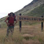
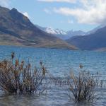
The official Te Araroa route goes up the Timaru River and crosses a saddle to reach the Ahuriri River. Talking to the other trampers on the Motatapu track, the name of the Dingle Burn came up repeatedly, with the implication that it was quite scenic. So I decided I would bypass the Timaru and hike the Dingle Burn instead. The road from the Timaru trailhead to Turihuka Conservation Area, a tiny patch of trees at the base of Dingle Burn, skirts Lake Hawea for many kilometers. It was a gorgeous day and I greatly enjoyed the views, even stopping to take a swim.
Lake Hawea is dammed to provide hydroelectric power, and when the dam was installed the lake grew substantially. This left Dingleburn Station at the north end without land access in or out. For a while the owner of the station brought goods and men up the lake in an old whaling boat, through all sorts of weather. This got old fast, and he brought in a team of excavators to dynamite a path along the bluffs. This was the route I walked today. Blast-scarred cliffs towered above me, and off the other side of the unmetalled road was a sheer drop into icy water.
I was having a great time, but the path wore on longer than I thought, and I was glad when I arrived at Turihuka, shortly before dusk. The trees here were scrawny and the sky clear, so I opted to cowboy camp again. Sandflies swarmed me throughout dinner and even after I scrunched up in my sleeping bag they started landing on my face. In a moment of invention spawned by necessity, I pulled out my hammock and draped the netting portion over my face. Voila! Instant bug bivy. The only animal to disturb me tonight would be the possum who woke me at midnight, grunting inquisitively as he approached my pack. I never saw him but hurled invectives about invasive species at him until he went away.
February 10th, 2009
Like many NZ trails, this one follows the river for which it is named, and I was afforded the option of walking along and through the Dingle Burn. I would make faster progress versus the more circuitous and hilly high water route, but as usual when fresh out of town, I was more than happy to trade an extra hour or two of walking for wet boots, so I took the high route.
Around noon, the orange DoC markers gave way to the two-inch slices of Venetian blinds cullers and musterers used to mark their trails in pre-DoC days. The trail turned down a steep spur, on loose sandy soil. “This is silly!” I thought, “I’ll be sliding down on my butt.” I figured I could find a better way down by descending the side of this spur at an angle and sidling across to meet the trail again. On my way down, though, a rock came loose underfoot, and I slid for a couple meters before grabbing a tree. As I brushed myself off I heard a muffled thud from below. I kicked loose another rock from the soil and watched it slide until, some twenty meters below, it disappeared. Moments later came another dismayingly emphatic THUD. That explained why the trail followed the top of the spur – off to one side the slope gave way to a tall cliff!
I paused a moment, hugging my new favorite tree tightly while I evolved a plan. Back up the way I came was out of the question, since I had skidded out of reach of the nearest tree. Sidling straight across would leave me exposed to another fall, and closer than I liked to the edge of the cliff. So I picked a diagonal route that would get me progressively further up the slope and back to the trail, while keeping me always within reach of a tree, whose roots would provide some measure of security in the loose soil.
Before long I was back on the trail, happily sliding along on my butt.
When I reached the river I had a big lunch, rested a while, and decided I could take the river route from here. This involves crossing the river repeatedly as it wanders back and forth. The inside of each curve is flat and covered with loose river rocks, easy to traverse. The outside is typically an embankment in the process of being cut away. Since the embankments are quite high, I had to cross once for nearly every bend in the river. After your boots get wet, this can start to be kind of fun, but I did start to get chilled, so I wound up wearing all my warm layers up top, while my legs had nothing but shorts and boots. It worked great – I warmed right up.
I never found Cotter’s Hut, where I meant to stay, so I hung my hammock in a wooded patch on the riverside.
February 11th, 2009
Exhausted and rain-shy, I stayed in bed late. I counted sandflies on the netting above my head to pass the time.
Today was much like yesterday, with nonstop river crossings. In the afternoon I was thrilled to reach a meadow on the riverside – I had been hemmed in by bush for so long it was a treat to see more than ten meters. A couple more stands of trees abutted the river, but soon the river valley was completely open on both sides, and I was in the upper valley.
I nearly missed Ben Avon Hut, till I turned around to admire a view. Behind a tree I thought I saw a suspiciously straight line, so I went to check it out. This historic musterer’s hut was used before this former station land was turned over to DoC as conservation land about a decade ago. It’s been designated as day-use for unspecified health and safety issues, which may be related to the possum droppings everywhere but are more likely structural. Camping is welcomed though, so I set about to hang my hammock.
As I walked through a stand of trees, I nearly walked right into a sheep leg, dangling by the foot from a twist of wire in the tree. The flesh was gone and the bones greenish with moss, but the knee joint still hung together with some unseen scrap of cartilage, and a couple strips of old skin still dangled.
My rational mind said this must be some perfectly normal remnant of the musterers’ activities ten years ago, probably making dinner from one of their flock. But the experience of almost walking into this bone had given me the unshakable heebie jeebies, so I picked up my pack and walked another half kilometer before camping.
The sandflies were tormenting me again tonight, but I’ve worked out a routine. Sandflies are both dumber and slower than mosquitoes, and are easy to escape at a walking pace. I set up a couple stations, generally one for my tent and one for cooking dinner. As I go about my evening routine, when the cloud of sandflies reaches a certain size, I simply walk away and attend to a different task until they’ve found me again. Repeat until bedtime, when my hammock provides a blessed refuge.
February 12th, 2009
This morning a chopper flew by as I was packing up. This isn’t so unusual, Kiwis are mad for helicopters. They’re used to provide farmhands easy access to high country stations, and for hiking, skiing, or hunting expeditions. This was the first whirlybird I’d seen on the Dingle, though, and surprisingly close to the ground.
Shortly after I started walking, I crested a hill to find the helicopter and three people walking down to the river. It was a fishing tour, flown up from a nearby lodge. Moments ago I’d felt like I was in this very remote place, difficult to access, and now I found I was less than an hour from civilization. No matter, I wouldn’t be seeing much of them, though they told me they’d dropped another group of three further up.
The second group was just having lunch when I met them. They had a really cool piece of kit, a Kelly kettle. This is a kettle with a chimney passing through it, which sits atop a can with a large gap in one side. You fill the bottom with dry grass and feed it with twigs once it’s lit. The flame and smoke, passing directly through the center of the kettle, boil the water quite fast. My hangdog thru-hiker expression must be less subtle than I thought, because the guide said unprompted “I’d offer you lunch, mate, but I’ve only got enough for three.”
I reached Top Dingle Hut, where the river peters out into a glorious circle of mountains, and the trail veers right to cross a saddle into the Ahuriri River valley. By evening I was at Ahuriri Base Hut, a nice little structure accessible by dirt road. I spent the night chatting with my two hut-mates: an Australian fly-fisherman on a two-week holiday, and an adventurous Englishwoman visiting Kiwi relatives she’d never met before, and generally seeing the country.
The Australian, Layton, is in IT but used to run a catering company. I watched, amazed, as he deep-fried some chips to go with a fresh-cooked steak. He offered me a bowl of chips, and they were perfect.
February 13th, 2009
In the morning, I gave Layton a message to text to Roxane, both wishing her a happy Valentine’s Day and warning her I would be out of the woods a few days after the date I had given her, since the last section was slower than I expected, and I still had the Ohau range to cross. I had plenty of dinner food left, though, and Layton, who was going home in a couple days, gave me some of his excess supplies to pad out my lunches.
The walking today was entirely on the metalled Ahuriri River Road, walking south to rejoin the main Te Araroa Trail. It was sunny but the morning chill lingered all day, making for a comfortable walk. Along the way I had two realizations. First, I wasn’t running as late as I thought I was. My camera, on which I rely for date and time information, was set one day in the future. My other realization was that in order to access the Ohau range, I needed some permissions I had neglected to phone ahead for. Fording the river could have bypassed the private land, but it was much too deep here.
In addition, two friends, Blair and Suzanne, were coming to the South Island soon with Roxane. I decided I would walk out early and return to do the Ohaus later. By this time it was rather late and I cowboy camped on the banks of the Ahuriri, a place with an inexplicably low sandfly count.
February 14th, 2009
I woke with the sunrise and walked the rest of the way out the SH 6. I had little luck hitching a ride until I sat down and started eating my lunch, at which point a ute came along and gave me an exciting ride into nearby Omarama.
I finished lunch and dialed Roxane to make plans. She and our friends are heading to Abel Tasman National Park in a couple days. I’ll be hitching up North to meet them and spend some time off the trail. Abel Tasman is supposed to be beautiful, and I won’t see it as part of my hike, so this seems like a great opportunity.
Hitching out of Omarama was great. Right away an SUV stopped, with a couple that was on their way to Christchurch. I had expected to need at least three separate rides to get there.
Along the way we stopped at Lake Tekapo to let the car’s radiator cool off, and I took a dip in the lake’s glacial waters, much to the amusement of my companions. I came out a bit dizzy from the cold water’s effect on my inner ear, but much refreshed and noticeably less smelly.
February 15th, 2009
I had a lovely time in Abel Tasman with Roxane, Blair, and Suzanne. From Christchurch I took the TranzCoastal railway, a lovely five-hour ride along the coastal hills. When I detrained in Picton, Roxane was waiting for me. This scuttled my plans to surprise her at the ferry with some belated fourteenth flowers, but I was happy to get to see her earlier.
We all drove up to Motueka and spent a couple days kayaking and swimming on the gorgeous beaches of Abel Tasman. We then proceeded west and south along the coast, through pancake rocks and wekas and coastal tourist towns that want ever so badly to be up-and-coming. Roxane has more details in her blog’s February Archives.
I splintered off at rainy Fox Glacier, where Blair and Suzanne were taking a helicopter to the top. I left Roxane at the hostel watching a silly movie, and felt like an idiot standing in the rain for an hour sticking my thumb out at an almost completely empty highway. Of course, if I had waited for the rain to stop, I would probably have been there long enough to get New Zealand residency.
Much to my surprise, I eventually was picked up by a courier van. It’s been my experience in New Zealand that working vehicles rarely pick up hitchhikers. I was lucky, too, that the driver was going all the way to Wanaka, my destination for the day. So I had an unusual ride, sliding around in the back of a van with the parcels and letters and, briefly, a grocery flat of bread loaves. These were introduced into the van at what looked like a warehouse or garage, and dropped off at a gas station. I never did ask the driver about that. Unfortunately, the lack of windows in back meant I couldn’t see Haast Pass, reportedly beautiful. But the driver had thoughtfully installed a speaker in back so I could listen to some rocking eighties tunes on the long ride: ♪ “Highway to the Danger Zone… Ride into the Danger Zone…” ♪
I arrived in Wanaka and was surprised to find most of the backpackers full, but I found one non-BBH place with a vacancy. In internet reviews it got panned, and rightfully so, but at least it was a bed for the night.
February 23rd, 2009
From Wanaka I managed an afternoon hitch to Twizel, where my bounce box was waiting for me. This small town has no proper post shop, and the clerk at the hunting and fishing shop that serves in place of one grumped at me. “You’re lucky it didn’t get sent back, I’m only supposed to keep it ten days.”*
Next stop was the local DoC office for further info about the nearby route. There was a real keen worker there who has been marking the trail through the Tekapo region. The result is one of the best-marked sections of Te Araroa I have yet seen, including noticeable sign boards at many road crossings that specifically mention the long trail. The irony is that this area is also one of the most straightforward sections of the walk, consisting primarily of lake edges and hydroelectricity canals.
Once I’d finished quizzing the DoC staffer, I sat outside with my maps and notes, recently retrieved from my bounce box. The news wasn’t great. I have about a day’s walk to the north to reach Tekapo, but past Tekapo is a remote nine day section with no convenient exit. This is unfortunate because I’m planning a rendezvous with Blair on March 2, to hike the Routeburn track over our birthdays. So I have only six days of hiking, and I have to end somewhere hitchable. On the other side, there is a two or three day section between the Ahuriri River and Lake Ohau that I skipped because I needed permissions I hadn’t called ahead for. I had thought to ignore it, since I don’t like having to ring up landowners, but now it’s back on the table as one of the few things I can get done in six days.
I spent a while pondering and planning, and soon realized it was getting late. I didn’t want to stay in town, so I started walking. There is an “informal campground” only 12 km north of Twizel on the shore of Lake Pukaki, so I set out for that.
The trail was easy, a very well-marked trek following a fenceline across paddocks. But I find my emotional state greatly affects my walking, and today I was feeling lost and uncertain because I wasn’t sure where I’d hike tomorrow. So my feet dragged and I felt exhausted. Fortunately the trail wasn’t long.
Approaching Lake Pukaki from the south, the trail interects the bones of the Pukaki River. Once quite powerful, this river has been sucked completely dry by the hydro dam at the bottom of the lake. Now it’s a forty meter dormant bed of shingle and boulders, giving off the impression that at any moment the river could leap back to life in a roaring flood. But even when Meridian Energy opens the flood gates for an annual canoe run (or in five-year heavy rains), the water level rises only glacially, giving plenty of time for a surprised tramper to get out of the way.
Soon I was at the campground, a piney spit of land populated with a handful of RVs and a car-with-tent. Most were arrayed along the northern edge, which affords a great view of Aoraki / Mt. Cook when it’s not covered in cloud, as it was tonight. I made a dinner and hung my hammock atop a small rise, pondering my route as I fell asleep.
*For those interested, I later found out: NZ Post will hold a Poste Restante package for two months by default, and three if you ask them. But registered packages only get held ten days. So don’t mail your bounce box registered.
February 24th, 2009
As I woke up this morning, my plan for the next few days was crystallizing. I would hike north to Tekapo today, then hitch backward (south) to Lake Ohau and finish up the crossing to the Ahuriri River. I would take the Maitland Stream route through that section, which requires only a single permission and seems more established than the official Te Araroa route.
The track from here follows the bank of Lake Pukaki, and I enjoyed some of those great Mt. Cook / Aoraki views promised yesterday. Though I had a plan now, my feet were still dragging. Maybe I packed too much food for this section, or maybe I was just out of shape from my week of relaxation. Lucky the lake was beautiful or I might have been frustrated.
Lake Pukaki is fed by glacial runoff from the Mueller, Hooker, Tasman, and Murchison Glaciers. As these glaciers grind down their respective valleys, they carry away pieces of the Southern Alps, ranging from boulder-sized erratics to micron-sized rock flour. This rock flour stays suspended in the rivers and lakes, giving them an astonishing opaque turquoise* color.
The end of the day brought me to Tekapo B penstocks, still on the edge of Lake Pukaki. Here a pair of mighty pipes slope down from the canal above, providing the necessary pressure to spin the turbines in a massive power plant which hums along offshore, discharging into the lake.
The weather looked fine, so I found a flat spot and cowboy camped. Just as I was falling asleep, I thought I felt something across my feet. A possum? I squinted, glasses off, at the dark. Is that lump on the ground a rock, or a bundle of clothes. I kicked at it at found it surprisingly soft, so I pulled out my glasses and flashlight. It was a hedgehog, now quite thoroughly terrified, but no less adorable for his fright. He was executing his primary defense mechanism of standing still and being prickly. After some thought, I classified him as “unknown threat level” to my pack and food, so I tried to flip him over with a stick. The hedgehog promptly executed his secondary defense mechanism, “running away.” I slept peacefully the rest of the night.
*Days later, hiking with Blair, I would struggle to define this color, settling on cobalt blue. Lucky for us, a man with a very big camera around his neck happened to overhear us and chime in. This resulted in a conversation that ranged from teal to aquamarine and finally settled upon turquoise. I would like to thank this nameless hero for his assistance.
February 25th, 2009
Today I set out along the canal that feeds those giant pipes leading into the power station. This region has a number of lakes dammed for hydro power, and they’re chained – each drains into another, allowing energy to be extracted from the water several times before it reaches the sea. This is rather common in hydropower systems, but what’s interesting about the system here is that it’s “sideways.” Rather than building a series of dams descending a single catchment, Meridian Power built canals carrying the water south from one catchment to the next. As a result, rivers Pukaki and Tekapo now sit dry, their output channeled into Lake Ohau, and from there the Waitaki River.
This particular canal is especially unique because it is home to a salmon farm. A series of rafts supports a series of salmon pens, and visitors can walk around and throw fish food in the water to watch the salmon leap for it, then return to the visitor center for a sashimi tasting.
The canal also hosts a number of fishermen along its banks, primarily south of the salmon farm. They are after brown trout, which grow fat off the scraps of food that escape the salmon. The largest recorded catch here was 35 pounds, which I have gathered is quite big for a trout.
At lunchtime, a pair of cyclists on a tandem pulled up for a break opposite me. I waved hello and turned back to my peanut butter and jelly tortilla. It was only when two men on pennyfarthings rode up that I started paying attention. Right on their heels were three more, then a “normal” bike, then two more pennyfarthings. I started talking to the first couple and found out their bike was no ordinary tandem, but a very early Victoria, lovingly restored by a Christchurch expert until it looked new. They, along with the highwheelers, were on a cross-country tour from Mt Cook to Christchurch, organized by a classic cycling club in Christchurch.
While I was quizzing the tandem riders on their bike and their tour, a series of shiny classic cars started whizzing round the corner, mostly sporty little open-top two-seaters. Good weather and a nice weekend seems to bring out all the lovers of vintage transport.
I finished eating, and it was time to start hitching back to Lake Ohau. I hadn’t gotten all the way to Tekapo yet, but I was ready to declare this section done on account of it being a roadwalk. The presence of the canal added sufficient interest to walk the first 20km, but not enough for the remainder.
I got a ride to Twizel with a local on his way home. He was a fly fishing guide, and we had a fascinating conversation about the nature of fly fishing that, again, almost made me want to try it. We also had discussed the brain-body connection, green energy, and the viability of the tokamak as a vessel for fusion power generation. Even if I don’t go buy a pair of waders and a rod, I think I need to start hanging out with more fly fishermen.
From Twizel I thumbed easily to Lake Ohau, and started walking up the gravel road as a light drizzle started to fall. I sheltered under a willow tree by the banks and watched the lake generate interlocking rings from the raindrops.
February 26th, 2009
I made quick progress in the morning, around the side of Lake Ohau on a dirt road. When I came to Lake Ohau station, I knocked on the door of the homestead. Two days ago, when I called for permission to cross their land, the woman on the phone said “No problem, just come knock on our door when you get here so we know for sure when you’re walking through.” An iconic Kiwi farmer answered the door, barrel-chested and wearing shorts with his workboots.
“Right-o, thanks for letting us know. You know where you’re going?”
“Yep!” I answered, perhaps a little to quickly.
“Good as gold, good as gold. The track’s up there, give us a ring when you’re out the other side.”
I set out on the four-wheel-drive track he’d indicated, ascending quickly up one of the mountains bordering Maitland Stream. The track was covered in sheep exhaust and I thought, as I climbed, how sick I am of tramping across station land. Give me a good beech forest any day.
Lucky for me, my DoC brochure described this route as “a well-marked track through beech forest beside Maitland Stream.” Well, there was Maitland Stream waaay down there, and I could see the beech forest staring only a couple kilometers up it. But the bluffs around it were getting steeper, the road was climbing higher and my chances of climbing down there were becoming slimmer. I convinced myself I had missed the turnoff from the farm road onto the trail proper, and started scrambling down to meet the river. Along the way I found several well-worn but unmarked tracks. They all turned out to be sheep tracks – often useful in rough terrain, but merely deceptive today.
I joined the stream, and still no orange markers greeted me. I strained to see some on the other side, but no luck. I followed the true right upstream for a bit, and even found a track or two, but no markers.
Perhaps the brochure was just wrong, there was no track, and I’d just have to use the river as a trail. That isn’t an appealing thought: the river is slightly high from recent rains, and very cold. Further, I only have three full days left to get across to the Ahuriri and hitch down to Glenorchy to meet Blair.
I made camp while pondering these things. I figure I can get my feet wet in the morning.
February 27th, 2009
In the morning I tried fording the stream, but still found no trail. The stream was rather high, too. If I took the bushman’s route and followed the stream all day, I’d be in and out of the water constantly. My progress would be so slow I’d most likely not meet my rendezvous with Blair in Glenorchy, and possibly I’d hit the panic date I left with Roxane for my safe return.
So I turned to walk back to Lake Ohau Road, defeated. But not before an exhausting scramble back up the hill, through gorse and brambles, to see if I had missed a blaze somewhere. Nothing, nada, zip.
When I came back down to the homestead, the huge man I spoke to yesterday was mowing his lawn. I waved, and he took off his earmuffs.
“Good to see you again. I thought you might be heading out the other side?”
“Well, ah, it looked pretty rough up there so I turned back.” I mumbled.
“Ah, the weather?” asked the farmer.
“No, the track, or rather I never did find it, and I guess it just goes up the river or something?”
“Hmm,” said the farmer, “nope, there should be a real good track up there. We go up there with chainsaws sometimes. I can make it to the hut in three hours on a good day. Did you find the boot nailed to a post?”
“Uh… boot?”
Turns out I needed to follow the four-wheel-drive road much farther than I had, even as it climbs away from the river, till I see an old boot on a post. That marks the turnoff onto the track proper.
I looked at my watch – 3:30. I could make it by dark if I really hustled, and if I made it to the Ahuriri tomorrow, I’d be set to hitch to Glenorchy on Monday.
I set off back the way I came, traversing that steep four-wheel-drive road for the third time, but this time I was on a mission, pumping my arms to go faster. Sure enough, I found the boot and was soon gliding along a beautifully maintained track that descended into forest. I was having a great time, until the rain started.
Before I split ways from the girls at Fox Glacier, Blair loaned me her favorite poncho. I was carrying it instead of my rain jacket and pants as an experiment. It’s lighter, and can double as a ground cloth.
Turns out the disadvantage of ponchos in general is that they are not good windbreakers. The disadvantage of this poncho in particular is that it is just the right size for Blair, making it a bit too short at my arms and legs. When I tried it on a week ago this hadn’t seemed a big deal, but today, in only a moderate rain, I was becoming thoroughly chilled because of that little bit of exposed flesh. When I tried, and nearly failed, to peel open a Snickers bar I knew I was in trouble. I redoubled my speed to generate extra heat, and soon I was at the hut.
A beautiful hut it was, too. Tidy and well-sealed, it even had a fire built in the fireplace just waiting for a match. It was clear the farmer who had been doing maintenance on the trail also put a lot of care into this hut. There was a stack of ancient National Geographics, and after changing into dry clothes, I ate dinner in my sleeping bag, reading about the Apollo 8 moon shot, with advertisements for Kenmore dishwashers, “now available in the popular new color, goldenrod yellow.”
February 28th, 2009
It was misty and cool when I left this morning – lovely weather for hiking. The well-marked track went only a few hundred meters farther before the beech gave way to open tussock.
I was a little disappointed but not surprised to find that the route from here over the saddle was not marked. Routes such as this one, that follow a river, are often left unmarked. After all, what better marker than the river itself?
Without a poled route, though, there is no opportunity for the concerted action of many feet to forge a path through the vegetation. So I started bashing through knee-high tussock, eyes keen for the appearance of a track. One would appear, and I would follow it for a minute or two, then it would vanish again.
Then the spaniards closed in. No relation to the ceviche-loving citizens of the Iberian peninsula, Aciphylla colensoi is also known as speargrass or swordgrass, for the very sharp tips of its flat blades. It grows its outward-pointing clusters like a sea urchin, and this valley had the thickest cover of it I have seen in all of New Zealand, almost matching the tussocks one-for-one in some places. My battle with the swordgrass was exacerbated by the fact that I had removed the legs of my trousers to keep them from getting soaked by the dewy tussocks. I considered putting them back on, but it wouldn’t have helped much. Speargrass is plenty sharp enough to draw blood even through clothing if you bump it hard.
So going, I picked my way to the top of the saddle as fast as I could. In order to make my schedule I had to reach the Ahuriri River by tonight. Luckily the speargrass lightened up a bit once I reached the top. Now I was descending the Snowy River Gorge, with beautiful views on both sides.
I started to worry a little bit about the river crossing. When I talked to a DoC staffer, he mentioned that where the Snowy River Gorge meets the Ahuriri, there is a bridge. I think he said that anyhow. And my map showed the tramping route, unmarked as it is, going straight up to the river’s edge. I figured even if there was no bridge – and I hadn’t noticed one when I walked Birchwood Road last time – the river must be crossable there. Still, I worried. This was the one thing that could really scupper my plans.
On a high bluff over the Snowy River, I turned a corner and the Ahuriri was finally laid out before be. It was a lovely sight, but along with it came a nasty wind chasing down the valley, from which I had previously been sheltered. The wind brought with it rain, not heavy but cold. I donned my insufficient poncho and shouldered my way down into the valley.
By the time I reached the Ahuriri the rain had relented and I’d warmed up a bit. But to my dismay no bridge was making itself seen as I approached. I paced along the bank looking for one and found the damning evidence – a large wooden frame and two ground anchors. A bridge had once stood here, but had long since been removed or washed away.
I turned my attention to the waters. Last time I was here they were crystal clear. Now, with the rainclouds hanging abeyant overhead, the center of the channel was just dark enough so the bottom was obscure. I could tell, though, that it was too deep to walk across. Other options: I could walk north, through marsh, until the river became small enough to cross. I could walk south twenty kilometers, through unknown terrain, to the road bridge. Finally, there was the middle path: I could swim across.
Kiwi tramping practice is to use a pack liner in preference to a pack cover. During a river crossing, a pack liner creates a pocket of air inside your pack that serves as a floatation device in case you are washed away. My stuff was wrapped tight in a pack liner, so I knew it would float.
Advice I received at the beginning of the trail was that when crossing a river, if your feet leave the ground it is a serious emergency. Beside that, the general lethality of New Zealand rivers has been expounded to me at nearly every opportunity by both locals and guidebooks. They’re evidently one of the biggest dangers to a tramper here.
But the river before me was not rushing along. Despite its depth, it had a rather stately pace. There were no rapids downriver as far as the eye could see, and all told it was less than ten meters across. I’ve done the swim from Alcatraz to San Francisco – I know I’m a competent swimmer, in cold water even. My eyes and brain told me this was safe, I could do it, no problem.
But something deeper was terrified. I kept coming up with ways this could go bad – mostly hypothermia, possibly getting swept away faster than expected – but none of them were plausible. I just did not want to go in that water. I paced the banks, convincing myself it was the only reasonable option. I had to keep moving to maintain my body heat, otherwise I’d never get in.
Finally, I resolved I had to do it. I went through a number of minor rituals to convince myself everything would go smoothly. I replaced my glasses with a pair of disposable contacts lenses I carry, so I could not lose them. I doubled up my pack liner by stuffing it with its spare. I took off all my clothes, and out of false modesty or maybe a sense of “this is what you swim in,” I donned my swim trunks. I tied my boots securely to the outside of my pack. All this had to be done quickly, because once I took off my clothes I quite quickly became cold.
I stepped into the water, surprised a little by the softness of the mud and how far it squeezed between my toes. But after the next step, and the next, my weight wasn’t borne by the mud anymore. I unshouldered my pack and hauled it by one strap as I scissorkicked my way calmly across the water. It was slow going, pulling a pack and unable to coordinate my whole body into an efficient stroke. But once I was in the water I was calm. This was familiar, and I knew how to proceed.
Soon my feet were sinking in soft mud again, on the opposite bank. I grabbed a thick handful of tussock and hauled myself and my sopping backpack out and onto Birchwood Road. I danced around, shouted a bit, and shook my fists in the air. This was all to regain the body heat I had lost in the crossing, naturally. Unwrapping my pack liner I found all my clothes still perfectly dry inside, and quickly put them all on and got walking.
My spirits were so high I barely took note of the complete emptiness of Birchwood Road. Though it’s only a metalled country road, the last time I walked down it, I was passed by vehicles about twice an hour, and was offered several rides. I declined because at the time, I considered it part of the trail that I should walk. Now it was part of the trail I had already walked, and my plan was to hitch a ride out to the highway and from there, to Glenorchy to meet Blair and hike the Routeburn.
But back when I was offered all those rides, it was a sunny Sunday afternoon. Fishermen were heading home after a day stalking trout in the Ahuriri’s clear pools. Today was an ugly Monday evening, and the river was temporarily hiding her trout under dark water. In other words, no fish = no rides.
But I didn’t worry too much. I only had twenty-two kilometers to the highway, and if need be, I could hike that all tomorrow, though then I would have only an evening’s time left to reach Glenorchy. I swung along happily making as many miles as I could in the last couple of hours before darkness, and waving my thumbs at nothing at all.
Before the night really closed in, I found a nice hay shelter and laid out my sleeping bag in a corner edged by high walls of hay. I had a roof overhead, was surprisingly warm despite the wind, and everything smelled lovely as I drifted off into dreams of a hay bale house.
March 1st, 2009
I was certain I’d find an easy ride to the highway this morning, but as I trucked along the road, I was passed by only a single car: a pair of women who gave me a half-smiling wave as their van rumbled by. Hitchhiking, I see that wave a lot and have come to interpret it as “terribly sorry, but there’s no way on earth I would give you a ride.”
I was enjoying the walk though, and as often with terrain one has seen before, it passed more quickly the second time. By lunchtime I spied the highway atop a rise.
I was a bit concerned I would have trouble getting a ride, because despite the high traffic volume, the cars were zipping by at high speed with no convenient place to stop. But as I approached the road, a tattered but sporty looking black car was rounding the corner. Not even on the asphalt yet, I raised a half-hearted thumb towards the driver.
To my surprise, he started decelerating hard. Even so, he was thirty meters past me before the car was completely stopped. He executed a daring u-turn and pretty soon I was speeding along in a low-slung seat with a fellow wilderness fanatic, on holiday from school in Australia. We spent the ride chatting about past adventures had. He spent a couple summers as a surveyor for New Zealand’s national geographic authority, taking spot hikes for peaks in Fiordland. This is one of New Zealand’s most inaccessible and most beautiful pieces of land, with nearly zero roads and hardly any tramping tracks. So his job involved being dropped by helicopter on some ridge, taking measurements and walking its length for a few days, then getting picked up and dropped on another ridge. I was drooling liters hearing him describe it.
He dropped me at a popular hitching spot in Wanaka. It was rather too popular, with one couple waiting at the first corner, another fellow up the road, and – as the couple told me – another one further beyond him.
I went for lunch, and by the time I came back the road was all mine. It didn’t take long to get to Queenstown. There I finally thought to check my email, and good thing – Blair had changed our rendezvous to the YHA in Queenstown instead of Glenorchy. We met up, and set out to do our shopping for the trail: tucker, fuel, and books.
March 2nd, 2009
“Should be good weather for you,” said our driver on the way north from Queenstown.
“Why’s that?” I asked.
The wind, he said, was coming from the south, which could be seen by watching the direction of waves below on Lake Wakatipu. Southerly winds bring calm weather in New Zealand, while northwesterlies bring rain and foul weather. And indeed it was shaping up to be a bright and sunshiney day.
We changed vans at Glenorchy, and after a short ride across metalled roads, we were at a surprisingly sophisticated trailhead shelter. The on-off point for the Routeburn track not only has a roof overhead in case it rains while you wait for transport, it has flush toilets and an interpretive nature display!
The Routeburn is one of the most highly renowned of New Zealand’s Great Walks, traversed by tens of thousands of feet every year. There are four huts along the way, each charging $45 per night to stay. Most trampers stay two or three nights, so you can imagine that it’s one of DoC’s biggest earners. Because of both its popularity and wealth, it receives a lot of trailbuilding attention. So the track we set out on was beautiful: benched deeply into the hillside, evenly metalled, and well drained throughout. Every little stream was bridged, and the track was wide enough most places to walk two abreast. Starved for conversation, I took full advantage of this and yakked Blair’s ear off all morning.
About an hour in, we passed a shiny new toilet propped up on stilts near the trail. We learned from a passing guide that it hadn’t been there last time he was through. They must have installed it very recently – maybe I was the first to use it!
We continued our ascent on the side of a deep gorge, with the glassy clear waters typical of New Zealand falling and pooling far below us. Before long we reached a broad river valley named Forge Flats. The trail was rather crowded, as we had expected. At one quiet point Blair and I sat down to rest where there was a small view. Then a couple of other trampers stopped to see what we were looking at. Soon our whole little section became clogged with people stopping, looking around, and asking each other in dozens of languages “What’s are all these people looking at?” We decided that for lunch we would ford the river for a little sun and a little quiet on the other side.
The climb from the valley floor up to Routeburn Falls Hut was supposed to be the big challenge of the day, but with a little huffing and puffing we made quick work of it. Around two o’clock we arrived at Routeburn Falls Hut, surprised to be greeted by the sounds of pop music, saws, and hammers. Between the DoC hut and the guided walks hut behind it, a dozen men were hard at work building a third hut to expand the guided walk capacity.
The other surprise was a strong outhouse smell. It turned out we happened to arrive on the day that Routeburn Fall’s four large solid waste tanks were being pumped out into metal biohazard cannisters to be airlifted out to civilization. A pair of white-suited DoC workers scrubbed and soaped the hoses and tanks. Asking the hut warden later, we found out this operation is only executed once every four or five years, so really we were lucky to catch such a rare event! We hoped to watch the helicopter carrying out the cans, but it wasn’t going to make pickup until late the next day.
The warden was a highly kinetic, gregarious guy. When we managed to intercept him long enough to ask about day walks, he described a nice side trail west of the hut that would take us up to a pair of tarns and a nice view down the valley. It was a lovely walk, and much less trafficked than the main route.
We returned and made dinner in the large dining room. The warden gave his evening speech: the fire exits are here and here, please don’t hang around the helipad if we have to medevac somebody, you are liable to get your head knocked off by a rotor, etc.
Then he announced a little contest. There was a large banner on the wall in thirty languages proclaiming “Welcome to Routeburn Falls Hut and Merry Christmas.” The ranger said that if any group or the whole hut could identify twenty-five, they’d win a pound bar of chocolate.
Blair and I gave it a go, not so much for the chocolate, which was just Cadbury’s, but for the challenge. Our sole competitors were a group of Kiwis living in Australia and back here on holiday. After a bit of taunting we all decided to join forces and merge our answer lists. But they had guessed in the same places we did, so in the end we entered separately.
We missed the bar, getting only twenty answers right. Some of the trickier ones we missed: Timorese, Basque, and Burmese. Really we never had a chance, though the warden said he holds the contest every night and frequently has a winner.
March 3rd, 2009
Today is the alpine crossing portion of the Routeburn Track. We had stunning views as we climbed a well-graded track up through a high valley. We walked around Lake Harris, a surprisingly large lake to find at such an altitude. We made a side trip to the top of a nearby peak, which had 360-degree views and the kind of wind you can lean deeply into without falling over.
We ate lunch at the saddle. There are two day shelters here - one run by DoC, and the other run by Ultimate Hikes, a company that runs guided walks on the Routeburn for $1,000 per person. They have a parallel hut system along the whole track, where trampers get a cooked meal each night, and don’t have to carry any gear except their clothing. We passed a number of people on these guided walks, since they run opposite to the direction most non-guided trampers walk. Blair and I were surprised to find that most of them were not old or infirm, and spent a long time speculating on what motivates someone to spend so much money on a three-day hike.
On the whole it was a gorgeous day and the scenery could not be beat. We didn’t have far to walk, so we took it slow and enjoyed it, and soon found everyone on the trail was ahead of us!
On the trail approaching Lake MacKenzie, we came across several sturdy nylon “shopping bags” filled with gravel, each a meter and a half across. Talking to the hut warden confirmed these were dropped by helicopter, and during the day when no one was at the hut he would go out and empty them to cover the trail. Each bag contained about nine hundred kilograms of gravel, and he could shift five or six of them in a day. At first I wondered if this was possible – some quick calculations revealed this was six tons of material – but then I recalled the old song “Sixteen Tons,” about coal mining, and figured moving a ton is not so hard if you’re doing it a shovelful at a time.
The warden was a shovel-nosed fellow with a big Canadian Mountie’s hat and a quiet demeanor. His evening speech started out quite dull, but as he went on, his dry sense of humor shone through, until he had the whole hut in stitches. He was close to the polar opposite of the warden from last night.
We spent the evening again with the Kiwis from Australia, playing cards and yakking and having a grand old time. They were all impressed that I could do a bridge shuffle – apparently it’s not at all common here.
Blair brought out a steamed pudding with a candle in it, and the whole table sang Happy Birthday. It was quite nice.
March 4th, 2009
We spent another slow and lazy day today – we had long since concluded that taking three days for this hike was really conservative for our pace, so we could lag a bit. Most of the day was a sidle along a long ridge, though I use “sidle” lightly because the trail was beautifully benched the whole way. We were approaching Fiordland all day, and the region made itself known with some impressive waterfalls that touched down right near the track.
After a pleasant nap at the final hut, we reached the trailhead around five. It hadn’t occurred to us that hitching at this hour might be difficult due to low traffic. We waited a while, and our hearts leapt at each passing car, but sure enough we found a ride – a really nice British couple that wanted to stop and see all the highlights along the way. This was fine by us, as we wanted to see everything too. In particular there was this one amazing gorge where stream-borne rocks had ground amazing curved shapes into the walls. An informative plaque said this was the result of harder rock upstream meeting the softer rock downstream.
We stayed at Milford Lodge, right near the sound. Today is Blair’s birthday, and I made fudge, which was delicious. We met a cycle tourist who was travelling all over New Zealand, and spent the evening hanging out and drinking wine and celebrating both our birthdays and the completion of the trail!
March 5th, 2009
It rained all night, big fat drops that we could hear on the roof. In the morning it was still pouring, and we had kayaking scheduled. I was apprehensive, but they say that Milford Sound is best seen in the rain because water pours off all the mountains, creating innumerable waterfalls where before there was a countable number of them.
Our guide showed up at the lodge already dressed in full kayaking regalia, his neoprene “skirt” dangling assymetrically in front of him. We got a short ride to the Sound, and were soon being issued thermal leggings, tops, heavy fleece, and rain gear. They’re experienced with bad weather here, getting three hundred rainy days a year.
Blair and I were quite comfortable as we set out in our double kayak to explore the sound. We were a bit sad that we had to stick near our group, but evidently they wouldn’t rent kayaks for a non-guided tour. We had fun even so, drifting near waterfalls and mistaking a seal for a dolphin. The low mist made the mountains look magical. As we got further out, the weather got rougher, until there were meter-and-a-half swells in the middle of the sound. Our guide made the decision to turn back, and we followed along the coastline where the water was a bit calmer. We still got the chance to “surf” the kayak down some big waves along the way.
Back at the docks, the weather had calmed down a bit, and Blair and I wanted to practice re-entering the kayak after a capsize. This is an essential safety skill if you go kayaking without a guide, and this was a handy time to try it, with land and dry clothes easily at hand. Our guide looked at us like we were a bit crazy, but hung around to make sure we didn’t die.
It was surprisingly easy to get out of the kayak underwater – once you pull your skirt free, the lifejacket bobs you to the surface. The hard part is balancing the kayak while you get back in. It’s easier in a double, because your partner can hang off the other side to balance out your weight. Still, you need to keep your body weight low along the kayak, and as the kayak takes in more water it becomes even tippier. Several times we were almost in, when we re-capsized.
Finally we made it into the kayak and onto shore. Surprisingly we weren’t too cold for all our repeated dunkings – the warm gear they had given us did a great job. We were pointed to a canvas tent where they had a “jet heater” set up – this was a propane heater a meter and a half long and twenty centimeters wide that blasted out hot air at an incredible rate. Looking down its bore really did feel like staring a jet engine in the tail.
Our bus from Milford back to Queenstown picked us up after lunch, and it was still raining like mad. The ride home was unbelievably beautiful though. As we wound up the road, each turn revealed a new rock face just streaming with water. It was a bit surreal at times, and doubly so when we entered the kilometers-long tunnel through the mountains, dimly lit and also pouring with water that seeped through the rocks.
Of course, on the other side of the tunnel it was clear and sunny. It took a few more hours to reach Queenstown, where we got some well-deserved rest.
March 6th, 2009
I was still busy making arrangements as of this morning, most importantly booking a jet boat to cross the Rakaia, which is generally too high to ford. I wasn’t looking forward to spending $175 on the crossing, but the only alternative was a long hitch on a lonely dirt road to a road bridge 40 km from the trail.
Evidently the owners of Ryton Station used to run a jet boat operation that was handy for this crossing, but the station has been sold. The new owners referred me to an operator who is based at the Terrace Downs golf course, down near the road bridge. When I called them and explained I only wanted to be ferried across the river, not down to their golf course or from the course up the river, it seemed to confuse them to no end. I got passed from one operator to another, who told me she’d have the guy who drives the boat call me back. He never did.
Eventually I started the long walk up the east side of Lake Tekapo. The weather was ominous but not yet raining. As I went along it turned to a light drizzle, then to my surprise – snow! It was a light dusting, and down where I was, it didn’t stick, but after an hour or so I could see a thin layer of white accumulated on the nearby ridge.
There’s a hut not shown on my map, but I had a description of its location and a grid reference. Before departing I had marked the grid reference on my map so it would be easy to find.
As I neared the confluence of Camp and Coal Creeks, it was starting to get a bit dark. Luckily the hut was just atop a little rise to my left – or so I thought. Thinking I had misread the map, I re-read it and started climbing the next highest rise. I bumbled around until it was so dark that I knew my feeble flashlight wouldn’t pick out a hut in front of my eyes.
The landscape was all tussock, so I couldn’t hang my hammock but would have to use it as a bivvy sack, on the ground. I was glad it had stopped snowing, but now there were intermittent sprinkles of rain. I pulled my rainfly atop my sleeping bag and anchored it with my boots. It performed quite well overall. I stayed warm through the night, though in the morning my bag and rainfly were quite wet with condensation from my body.
March 11th, 2009
I expected I’d find the missing hut a stone’s throw away by morning light, but it was fifteen minutes before I came upon it, at the end of a 4WD track exactly as described by my trail notes. The grid coordinates put the hut in the wrong place on the map. Lesson learned: always read the text as well as the map.
The plan for the day was up Camp Creek to a saddle. Unfortunately the route was unmarked and the going was a bit of a bash through tussock and occasional bogs. As I reached the head of the stream, I found myself in a bowl from which none of the saddles looked very inviting, but my maps pointed out a scree slope to the east which I dutifully surmounted.
I was much relieved to find a waratah standard at the top, wrapped in the standard orange tube DoC uses to mark its trails. This one, and all of its sisters I was to find on the other side, were neatly wrapped at the top with reflective tape, a considerate touch I became very grateful for.
The valley I now descended was a bit trickier than the average, with a sharp drop off partway down. The poles helped me to navigate around that part, but the terrain was still quite steep. It was also well-covered in slippery snowgrass, such that I slipped more than once and found myself sledding downhill for several meters. Once I recovered from my surprise, I realized it had been a lot of fun, so I did it a few times more for pure enjoyment. The snowgrass worked exceedingly well for this purpose.
But the day was getting late, and while sledding was strictly faster than walking, the slope soon ran out. I went on foot a ways, but dark closed in fast and I was again in the situation from last night: not yet at the hut, and perhaps unable to find it without better light. Tonight, though, I was helped by the reflectors on the DoC markers. I could swing even my feeble LED light around the valley until I was rewarded by an answering flash from the hundreds of tiny retroflectors on that blessed little patch of tape. I hurried to that pole and repeated the process.
I was not far away from the hut and soon recognized its square lines against the more natural contours of the valley.
I was glad to have reached my destination tonight, and doubly glad when I found that it had numerous candle holders, most of them holding the stub of a candle. After spending two evenings with darkness as my enemy, it was gratifying to light some of the candles and banish it, at least from within the hut’s walls. It certainly made preparing dinner easier.
A couple hours later, when I went outside to relieve myself before bed, I was greeted by the nearly-full moon. I felt a bit foolish that if I had waited a bit, I could have hiked easily by the moon’s generous light. But not too foolish – what would I have done in those two hours of waiting?
March 12th, 2009
Today would be a long day, I knew from the start. My trail notes indicated seven and a half hours, and the man who wrote them is quite fast – he listed yesterday as four and a half hours. The sign outside the hut gave a more realistic estimate of nine hours.
The trail descended Bush Stream all day, with a diversion around noon up behind a ridge to follow what looked on the map like a parallel valley. In reality, that “parallel valley” was just a series of tussocky valleys connected by high saddles. So all day it was up one saddle then down the other side.
On the plus side, the route was marked with waratah standards the whole way down. Unlike the Mavora Lake Walkway though, the poles were not spaced perfectly so from any one, you could just barely see the next. Instead they were spaced cruelly so the next pole was always just barely *out* of sight. Eventually I figured out that the absence of a pole meant “continue on same bearing, but not before losing a lot of time to second guessing myself.
I had to keep up a strong pace all day, so I tapped into my iPod to give me a marching beat. First I listened to some great dance mixes my sister gave to me at Christmas. Then The Kleptones’ “24 Hours,” a long double album. The last time I listened to it in full was on the back of Roxane’s motorcycle, riding home from an afternoon in Santa Cruz. The music built slowly, and I was back home, arms around my sweetie’s waist as we accelerated into the curves of the redwood forest. When the music got stronger, we were bombing down the foothill’s into the furnace of San Jose, and as the last few tracks lowered tempo, we entered a wall of chill fog at San Francisco’s southern border.
It was good cruising music, and it made the kilometers pass quickly. Listening all day was draining my battery, but I planned to stay at Mesopotamia Station’s hunter’s cottage, so I would be able to recharge. Of course, if I wasn’t so determined to reach Mesopotamia I wouldn’t need to wear down the battery to give myself energy. Sort of a reverse catch-22.
At Crooked Spur Hut the route turned into a proper track, and I was flying downhill now. I startled a pack of about eight chamois (pronounced “shammy” – by Kiwis anyhow), a species of goat introduced to New Zealand years ago as a game animal.
I reached the main dirt road about half an hour after sunset, and just in time, as it soon became too dark to navigate a trail. The road was easy to follow even in the dark, and as the stars came out I was pleased to recognize the Southern Cross ahead of me, plus Sirius and Canopus to my right. Then I noticed a new star to the left. It was as bright as Sirius, but I hadn’t seen it before. Then, even as I watched, it started getting dimmer. Less than a minute later it was gone. I wondered, had I seen a distant supernova? Or a gamma ray burst? The last message of a dying civilization? A weather balloon? If you have an idea what celestial phenomenon this could have been, please leave a comment. It was in the southeastern sky, maybe 45 degrees off the horizon, about 8:30 or 9 PM NZT. My latitude, longitude is approximately -43, 171.
I found the side road to Mesopotamia Station. Dogs barked in the darkness, making me unnacountably nervous. I was trying to use my flashlight as little as possible, to save its battery. Just before I reached the homestead, I spotted the full moon bubbling its way slowly past the eastern ridgeline. I paused briefly to admire it before walking up to the house. There were no lights on inside, so I was glad to see a note on the door telling me I was expected, and giving directions to the hunter’s cottage.
When I got there, I gloried in the simple convenience of electric lighting. A night that had been a race against darkness suddenly had no urgency left in it, and I cooked a wonderful dinner at leisure while I listened to an old fashioned AM radio drone about a recent flower show. Were the queues too long? The host cajoled his listeners to phone in their opinion.
I fell asleep with moonlight streaming in through the bedroom window.
March 13th, 2009
Reached the hut after sunset again. I hope this isn’t becoming a pattern. It’s been a good day despite that. I started slow this morning, enjoying the space to spread out my things and plan. I drank a cup of tea while I took a hot shower, and then another cup of tea while I analyzed the maps for today. It looked like about a fourteen-mile day - easy. Good thing, too, because with all my dawdling, I didn’t put on my pack till 10:30. The main challenge of the day would be cossing the Rangitata River.
I went by the main house to drop off my payment and chatted with a woman there about the river.
“Be careful,” she said, “It’s was high recently, and though it’s come down since, it’s still not what I’d call low.”
My trail notes say the Rangitata is crossable on foot, but qualify that with the words ”should be” and “usually.” Even after my recent encounter with the Ahuriri, I’m nervous about river crossings - probably a good thing. So I set out on the dirt road to the river, pondering what I might find, my pack liners doubled up and closed tight just in case.
Half an hour later I was passed by a four-wheel-drive. “You walking or do you want a ride?” asked the driver. The way he asked made it clear he understood the reasons one migh choose to remain on foot, and I politely declined.
He was followed right behind by another three vehicles. Just as I was about to step back into the middle of the road, another one came zipping along, and then another. It was a caravan of four-wheelers, fifteen of them all told. They stopped only a couple hundred meters ahead, where there was a carpark with a toilet. As I reached them I had an idea.
“Going across the river?” I asked a fellow who was looking for a rock or stick to let air out of his tires.
“Yep! We should be going up a little ways further, then shooting across the river.”
This suited me just fine. Why worry about the crossing when I could get a ride across in perfect safety, and keep my feet dry to boot? When the group started rolling, I got in his car and rode along. I had never gone four-wheel-driving before, and splashing up and down the various side creeks was a blast. My new friend had a CB radio in his car, and the ride leader was talking about some of the scenery ahead and around us. The group was part of a four-wheel-drive club based out of Christchurch, some two hundred and fifty strong. I had a look at their club magazine, listing upcoming rides and equipment that could be borrowed by members. It was very well produced, and even had a section on their didymo policies.
The Potts River valley was my target across the Rangitata basin, and as we watched it scroll by on the right, my host picked up the radio. “Murph, just to check – are we crossing the Rangitata today?” The answer came back “Unlikely.” A misundertanding about routes, I suppose. I thanked my driver profusely as he let me out and I started walking again.
I crossed a broad shingle plain before I came to the first small stream of the Rangitata and splashed across it. This is one of New Zealand’s many braided rivers, an ecosystem supposedly unique in the world. The river is composed of a number of streams, joining and splitting repeatedly along its length. In between streams are rocky islands of shingle and sand, some of which go long enough between being flooded to grow a decent plant covering.
As I plowed handily through streams no higher than my ankle, I grew happy. This was easy going! The fine sand gave the place a bit of a marine feel. Some native bird shrieked like a seagull, and I imagined myself on one of the rockier beaches of Cape Cod’s National Seashore.
The riverbed was broad, and it took me almost an hour to get across it. Crossing a braided river is a matter of walking up and down the islands to find the right spot to cross. A stream that is deep in one place may get shallower as it slips sideways across the tail end of an island to rejoin its neighbor. Similarly it may be easier to cross near the head, where it first splits away. These streams were all quite manageable, and I didn’t need to do much walking to find crossings that never went above mid-calf.
The northernmost stream is called Deep Stream, so when I crossed a stream that went to my knees and could see no more ahead, I declared myself done and stopped for lunch.
Soon after I started walking again, though, I came to another stream. This one was rushing furiously. I found a diagonal path across it that looked like it would be relatively shallow throughout. But the current grabbed at my feet whenever I tried to walk downstream. I turned around to face the current and crab walked sideways and backwards. The water came up to mid-thigh as I passed a boulder, and then quickly got shallower. My earlier cockiness was gone, but I made it across with no problem.
From here it was straightforward to head up the Potts River. The trail through here hasn’t officially been put in yet, so I had plotted a course that looked good on the map, up the river a ways, then climbed the hills on my right to a fence line, which I could follow over a ridge to the hut.
On a map, it’s easy to look at a bunch of contour lines and say “it’s a bit steep, but no problem.” In reality, those hills on my right were quite a bit bigger and steeper than I thought. My easy day was turning into a bit of a slog, but I was still in good spirits. The sun was shining, there was a cool breeze, and I felt like I could go all day, evem if I was resting every five minutes on this hill.
Up top, the fence line showed up just as promised, and as fences tend to do, took off in a straight line without the least regard for slope or convenience. Still, it was a great reference point in untracked territory, and it shot me right over the ridge, with a beautiful view, as I crossed, of Mystery Lake reflecting the lowering sun.
From there it was just a race, and once I found the four-wheel-drive track, I had an edge over the sun. There was still some twilight left when I arrived, but only by the slimmest of margins.
March 14th, 2009
I woke to my alarm this morning in an experiment to see if I can arrive at my destination before dark, by waking before dark. I’m taking baby steps though: the sun rose just as I was enjoying the hut’s well-built long drop, which has an eastward-facing door. Tonight I’ll set the alarm half an hour earlier, for a real test.
Starting out, I immediately had to cross two very cold streams, leaving me with numb feet. The first job of the day was a steep climb up untracked and unmarked terrain to a plateau in the Dogs Range at 1200m. I took this slowly, pausing often to admire the views and recover my breath. My feet soon thawed out.
Once at the top, it was easy going across low tussock. The sun got warmer as I went, and soon I came to the opposite side of the plateau and a beautiful panorama. Lake Heron was not far below, it’s shape resembling a 70′s electric guitar, with a round bottom and two points on top, curling up and around the sides of Sugarloaf, a large isolated hill standing where the guitar’s neck would be. Sugarloaf reflected in the glossy finish – er, I mean still waters – of Lake Heron.
I had a bit of gorse trouble descending from the plateau, and once I got down into the farmlands, I had a run-in with a muddy stream just barely too wide to jump. But other than that it was easy cruising the rest of the day, around Lake Heron and up the Swin River to Double Hut. Somebody put a solar-powered garden light atop a fencepost near the hut, which would be very useful for finding it in the dark. But I finally broke my streak and arrived an hour and a half before sunset!
March 15th, 2009
It looked like today would be tough going, so I had all the makings of tea laid out the night before. In the morning all I had to do was flick my Bic and I had that happy caffeine hit that I’m often surprised to find gives me as much of a physical boost as a mental one.
The target for the morning was a saddle at the head of the Swin River, but similar to Bush Stream, I’d be sidling high above it. It was a steep grunt all morning and a bit into afternoon, but not bad. It was a hot day and the cicadas were everywhere, often landing on my hat or face.
Across the saddle, I had to descend Round Hill Stream, also fairly easy since there was little scrub and the tussock was all short.
As I approached the hut, the valley closed in and I had to start crossing the river frequently. I knew I’d have to get my boots wet eventually, but I made a game of seeing how long I could keep them dry by rockhopping. Eventually I had no choice but to plunge my feet in, and from there I was in the water near-constantly for the next half hour. I was glad when I came to the confluence with Turton Stream and found Comyns Hut. The hut was upgraded in 2007 and has new bunks, mattresses, benches and a table.
March 16th, 2009
Today was to be a big day. Not in mileage – I expected to be done with walking by two or three in the afternoon. But today I would cross the Rakaia one way or another. I had never heard back from the jet boat operation at Terrace Downs, so my options were to ford the river or hitchhike.
As I walked the easy track, a four-wheel-drive-track upriver through cattle grazing country, I repeatedly pondered the language in my trail notes: “The Rakaia is only crossable on foot when it is very low.” It was the “very” that got me – how low is very low? Two hundred cubic meters per second (cumecs)? One hundred eighty? One fifty? Before leaving Tekapo I had checked Environment Canterbury’s river information. Then, it showed a spike in the flows of both Rangitata and Rakaia half a week before, almost returned to normal. It had been nearly an additional week without rain, how much lower would the river be?
I was suitably nervous about this crossing – my overview map of the South Island had a notation here saying “dangerous river,” put there by myself when I consulted with Geoff Chapple at the beginning of my trip. It’s the only river to receive that particular honor. Still, my more reckless self (atop my left shoulder) insisted that I was now an Experienced River Crosser and would have no trouble. My cautious self (shoulder right) managed to extract this promise: I would attempt for at least an hour to hitch down to the road bridge before I braved the river.
I lunched at Turton Saddle, where I got my first view of the river. Squint and stare though I might, I was completely unable to get any idea of how deep it was. As I descended I kept looking up and trying to make it out, but of course I wouldn’t get a meaningful idea unless I was right up against a given stream.
The country road at the base of the stream was indeed desolate – not many would be passing this way. But I dutifully sat down with a good book and whiled away my allotted hour, and more (it was a really good book).
The first vehicle to pass was a flatbed truck with three men crammed in the cab. The bed was only half full. When they stopped I explained where I was going, figuring maybe I could squeeze on the back. “We’re only going halfway,” said the driver, so I thanked them for stopping and sent them along. As they pulled away, I saw their cargo and was glad I had not taken a ride. They were carrying twenty four bee boxes, stacked three high and four wide, each trailing a small cloud of befuddled bees that had stepped out for a moment and were now trying desparately to keep pace with the truck.
After a time I was picked up by an Environment Canterbury worker and his very attractive intern. They had just been checking on flood defenses upstream, and were happy to give me a lift. They were agreeable company, and it was a few minutes of pleasantries before I had a forehead-smacking realization.
“Say… you’d know a bit about river conditions. Would you say this river is ‘very low?’”
“Well, it’s about as low as you’ll ever see it. You could probably walk across it right now.”
I nearly leapt out of the car for joy, but had the good sense to ask the driver to stop first. I scrambled down an embankment and was soon stalking the shingle islands looking for the best places to cross. I was just south of the confluence with the Wilberforce, and in this area there were just three major streams to cross. Each one was fairly difficult, with the last one coming up to my hips. But I chose my crossing points carefully, and soon I was across. I could hardly contain my excitement. This crossing was the major point of uncertainty for the current leg of my trip, and I had not only gotten across, I had done it on foot, a double victory. Triple victory, as matter of fact, since I had saved myself a day’s worth of walking between Lake Coleridge and Ryton Station.
I climbed an embankment and rested in a lovely pine grove, a near-perfect camp site. I almost did camp there, but I had a few more kilometers to go around the north of the Cotton Sheep Range, and wanted to knock out a few of those before dark, to make tomorrow’s hike shorter.
March 17th, 2009
I rose before dawn from my riverside campsite. I had made a few kilometers yesterday towards the nose of the Mt Oakden, but would still have to round it before reaching the Harper River, my path for the day.
I had thought I was well short of the Wilberforce, but rounding the end of the mountains, it was clear the river cut deeply into embankments too steep for me to sidle. Not a problem – I had mastered this river in combination with the Rakaia yesterday - surely I could master it today.
I was nearly through my first crossing of several when I happened to look up the Wilberforce valley. There I saw grey clouds and an unmistakable sheeting of rain. The string of fair weather that had given me such an unusually low river yesterday was coming to an end today. Past warnings flashed through my head about how quickly rivers could rise, and how one ought to be careful not to get trapped between streams of a rising river. I made haste to get through the necessary crossings, and it seemed to me the river was higher each time I crossed. But of course this was just because in my haste I was not as careful in choosing the shallowest crossing points.
I was relieved when I made it to the bridge over Lake Coleridge’s diversion canal. This lake is another source of electricity – in this case run by Trust Power, New Zealand’s first publicly-funded hydroelectric system.
By now the wind was getting fierce, and though the rain had yet to arrive, even the cows were piteously complaining to anyone who would listen. That being no one but me, so far as I could tell.
I was walking the flats of the Harper River when the rain finally came. It never came hard, but it was whipped into needles by the wind. Following the river was straightforward, and seemed to get easier when I reached a four-wheel-drive track. But the author of this track seemed to take especial glee in fording rivers, and I was back and forth across the river many more times than really seemed necessary.
At the end of the day I reached Hamilton Hut, a big DoC hut and modernly fitted out. It was nice to have a change from the musterer’s huts I’d been staying in. I was somehow surprised to find there were *people* in it. The fact that it’s listed as holding twenty people should have clued me in that it was popular, but I hadn’t shared a hut since Tekapo, and it was starting to seem the natural way of things.
My hut companions were a couple of Canadians, with whom I played Hearts all night and to whom I introduced the fine art of shooting the moon; a gestalt of Germans who introduced me to Tantrix, an intriguing tile-based game developed in New Zealand; and a duet of Dutch, who snored.
March 18th, 2009
I spent today on the popular Lagoon Saddle track, part of a three-day loop. Its popularity meant that the track was well maintained, a welcome change from the trackless river walking yesterday. I didn’t see many other walkers, but the hut books were well full, including the markings of one fellow who had found every entry complaining of bad weather or difficult terrain and marked next to them “Harden up!” There was also an entry by Martin & Einar from Norway. Under “main activity for this trip” they listed “ARMED TRAMPING.”
I was out to the road by three o’clock, and expected to have no trouble getting a ride, as this is the main thoroughfare between Christchurch and the West Coast. But traffic moved past at tremendous speed – terrible news for a hitchhiker. The only thing people like less than letting a seven-days-marinated hiker into their car is taking their foot off the gas pedal when they’re already doing a hundred twenty kilometers per hour.
I got one short ride, but it was three uncertain hours before I finally got picked up by a pleasant dairy farming couple that took me all the way into ChCh.
March 19th, 2009
From Christchurch I flew up to Wellington for the weekend, where Roxane and I spent a nice relaxing weekend walking around, eating, and meeting the friends she’s made up there.
I went for a run in Wellington’s botanical gardens, which are lovely. For the first time I actually saw some tuis. I’ve heard them constantly throughout my hike, but they aren’t “friendly” like the fantail or black robin, so they’re always just out of sight in the foliage.
We went to Te Papa, the national museum of New Zealand. It had a lot of great natural history exhibits. There was a cool multiuser interactive display called “The Wall” that Roxane and Sarah and I spent a while playing with. And there was a great exhibit on Maori culture, and on the Waitangi Treaty, which is generally considered New Zealand’s founding document.
Roxane was again dismayed at the amount of weight I’ve lost, but the pace has slowed. I think with all the eating I did in town I put at least a few of those pounds back on, though.
March 24th, 2009
I flew back to Christchurch and stayed again at The Jailhouse hostel. In the morning I expected to catch a city bus to the edge of town and start hitching, but it turned out I needed even a bit more walking to get into a good hitching spot.
Eventually I was picked up by a young German named Niklas, taking a gap year between high school and college. We had an enjoyable time chatting about jobs and school. Too enjoyable, perhaps, because as we passed through a town, a police officer passing the other direction flipped on his lights and pulled us over for speeding.
The officer did not seem inclined to be friendly or forgiving, and had an inordinate amount of trouble with Niklas’ German accent.
“What’s your home address?”
“26 Rotzeestrasse.”
“Spell that please.”
“Arr oh tee set…”
“Set? What’s set?”
“A letter, the last letter of the alphabet.”
“Set? There’s no such letter.”
Of course he was saying “zed,” and I felt like the officer was being purposely obtuse. Still, when he came back from writing up the ticket he was surprisingly kind. He explained that if Niklas didn’t plan on returning to New Zealand, he could simply disregard the ticket, but if he returned the ticket would be waiting, with fines tacked on. Then he said “If you’ve got room, there are a couple of very nice young ladies up the road with their thumbs out, you may want to pick them up.”
This was hilarious to me, since hitchhiking is illegal in most of the States, so to receive advice on hitching from an officer seemed very unusual. At any rate, down the road we picked up Hilary and Raissa, a lovely pair on their way to pick apples in Alexandra after a brief tour of the West Coast.
The road over Arthur’s Pass is exceedingly beautiful, and following a river valley and twisting between mountains and lakes. One of the most remarkable sights is Castle Hill, a jumble of weathered limestone rocks that calls to mind a ruined castle or walled city. Raissa mentioned as we drew close that the Dalai Lama had called this place a “Spiritual Center of the Universe,” so naturally we pulled over and had a picnic. As cool as it appears from the road, the front rocks of this formation hide an even more fantastic garden of shapes behind it. This is a bouldering paradise, with all sorts of interesting shapes to climb on and crawl across.
It was evening before I reached the beginning of the trail, but it was a day well spent. I had a short roadwalk that just used up the last of the light. I stopped at a roadside shelter intending to camp, when a huge bird circled low over my head. At first I thought it was a hawk, but after it circled twice, it landed gracelessly on the ground and I recognized its bright green plumage as that of a kea. It hopped sideways around me to get a look from all angles while a companion arrived and sat on the shelter behind me. The birds were the size of a large cat, beautiful, and completely unafraid. One of them came within arm’s reach of me. They say keas are extremely intelligent (like most other parrots), and watching them watch me I certainly felt their intelligence. I sat and watched them hop around the shelter picking at crumbs left there during the day.
I would have enjoyed communing with the keas all night, but they are also known for their destructiveness. They are so inquisitive that they frequently rip apart backpacker’s gear out of pure curiosity, generally in the middle of the night. These birds clearly felt that this shelter was their territory, so I moved on – there was another shelter only a few kilometers up the road.
At the next shelter I cooked dinner alongside a quartet of French girls. Their English was rudimentary so we only exchanged a few words, and they mostly talked French among themselves. I have no French, so to my hearing their conversation went “blah blah blah blah shitty shit!” I couldn’t suppress a giggle at the creative swearing. Then the girls realized the first word I had understood all night was a cuss, and everyone burst out laughing. I should have asked what the Academie Française would have thought of their using an English loanword.
March 25th, 2009
Today’s trail took me up the Mingha River, and made me deeply appreciate the system of national parks. There was more vegetation, more birdlife, and better track than on any single day of my entire tramp previously. I believe this is actually the first time my route has taken me through a national park. The weather was beautiful too, which added to the enjoyment.
I was about halfway through the day when I came up opposite a massive waterfall, hundreds of meters tall. I sat leaning against my pack and watched it fall, dozing in the sun. Pretty soon I fell asleep properly and had a little afternoon nap. No problem, because progress was easy today – I’d have no trouble reaching the hut.
This track is used by part of the Speight’s Coast to Coast race, a multisport adventure across the South Island. Because of this the hut books are full of entries like “Training for coast to coast,” “Counting coast to coast runners,” and so on.
I crested Goat Pass, and for the first time on my Te Araroa tramp I was crossing the Main Divide. Like America’s Continental Divide, this is a set of ridges and passes which split all rainfall in New Zealand into that which drains to the Pacific and that which drains to the Tasman Sea.
Immediately on the other side of the pass, the track standard took a turn for the worse, turning into a steep downhill scramble over boulders. I was hopping repeatedly back and forth across increasingly large river pools as the infant Deception River found its legs. I was often glad there was no rain, because slippery rocks would have made this much more challenging. I was very surprised that the trail was not of a consistent standard with the Mingha Valley trail, considering that both are used by the Coast to Coast race.
I stayed at Upper Deception Hut, an older hut with a real fireplace instead of a log burner. I still had daylight and was reading down by the river, when I was surprised to see a skinny tattooed Kiwi picking his way up the river, a cigarette dangling from his mouth. By now I have become so used to staying in huts alone that it seems a bit unusual to have company. But news from down the trail is always welcome, and my new companion had just come over Harper’s Pass, the route I was beginning. He told me the Deception tomorrow would be hard, but the rest should be fine. Most importantly he informed me of a natural hot spring about halfway through my trek. I looked forward greatly to having a warm soak.
March 26th, 2009
I woke to rain. This was unfortunate as my day ahead included much rock scrambling and river crossing. Fortunately it wasn’t heavy rain, and the Deception isn’t so long that it floods easily. Still, the track was rough all day, and rain compounded my low morale. It was also quite cold, so that I was wearing all my warm layers and hat underneath my rain gear. This protected me fairly well, though when it came time for lunch I was inordinately grump that my tortillas were getting soggy.
By late afternoon I had reached the bottom of the Deception River, where it meets up with the Taramakau River, my next destination. It also happens to meet up with a bend in the highway called Aicken’s Corner. I decided to try and hitchhike into Arthur’s Pass township, hire a bunk, do laundry and dry out indoors. However, just as I was making my last river crossing of the day, an easy one, I slipped and fell in, completely soaking my entire bottom half and part of my backpack. My important gear was inside my pack liner, but I later discovered that a small hole in the pack liner allowed water to intrude upon my sleeping bag. Oh woe is me! But at least I would have a warm bed…
A sympathetic driver on his way to a tramp of his own soon picked me up and whisked me into Arthur’s Pass. The backpackers was full. So was the other backpackers, as well as the motel, the lodge, and the bed and breakfast. Seems I wasn’t the only one with the bright idea to find shelter from the rain - just the slowest one!
Fortunately there was a fallback: DoC runs a campground near town, so for a mere $6 I could stay there. First, though, I visited the Wobbly Kea and indulged in a massive, delicious meal. I was extremely grateful for the Kiwi custom of not hurrying along restaurant patrons when they’ve done eating. I sat for a long time enjoying the afterglow of my meal, warming up and drying off.
When I got to the campsite, I just couldn’t bring myself to set up my hammock in the rain, now much heavier than it was. So I paid my fees and slept illegitimately but inconspicuously in the campground’s day shelter. Apologies DoC! I was glad that my sleeping bag was filled with a synthetic material, because down would have been rendered useless by the water that came in when I fell. Synthetic fills don’t have this problem, and I was still kept reasonably warm by my damp bag.
March 27th, 2009
Today I embarked on the Taramakau River, one of the more important Maori pounamu tracks in this area. Maori traders would make the trip from the West Coast, where pounamu (aka greenstone aka jade) was available, to the East Coast, where they could trade it for other valuable commodities - mostly food. Greenstone was greatly prized for both stone toolmaking and jewelry, because it is extremely durable as well as beautiful. The route up the Taramakau and over what is now known as Arthur’s Pass was the only one of these pounamu trails that was easy enough that whole families could be brought along. Further south the passes are more treacherous and only men would make the trip.
Today the Harper’s Pass is a fairly popular track, a moderate four or five days connecting the Arthur’s Pass highway with the Lewis Pass one. I had great weather starting out, which allowed me to spread out my gear at lunchtime to dry in the sun. It was an easy day spent on river flats.
When I reached Locke Hut for the evening, I saw there was some gear in one of the bunkrooms, and a note left by a visitor for the other inhabitants. I figured they were out on a day walk, and set about cooking my dinner. As night fell I began to get worried. When it was full dark, I was wondering where these other folks were, and what I should do if they never showed up. Go looking for them? Hike out and report them missing?
Of course it turned out they were hunters, and evening is the best time for hunters. They’ll generally get set up in a good position right around sunset and watch for deer as twilight falls, then hike back by the light of a headlamp. These two showed up about an hour after full dark.
New Zealand doesn’t have a hunting season as such; you can go into the woods and shoot a deer any time of year, with a minimum of regulation. But inasmuch as there is a hunting season, it is “the roar.” This is when the stags are in rut and roar to announce their presence to mates and stake out territory. This is great for hunters as it is a good way to pinpoint a trophy animal. Sometimes they can also bring a stag to them by using a horn to fake a roar. If they’re lucky, the angry stag will come looking for a competitor to drive off his property. One of the hunters said “I was watching you on that last approach to the hut, and saw you stop and have a slash. I thought about giving you a good scare with the horn, but thought ‘he might be armed!’”
March 28th, 2009
From Locke Hut to the top of Harper’s Pass was quite difficult. There’s loads of windthrow on the track, and though it’s been there long enough that a de facto alternate track has formed around most of it, the constant detours and crouching under fallen trees makes things hard.
As I reached the top, things became easier, and I cruised on down to the Harper’s Pass Bivouac. Bivs are tiny huts or lesser shelters that are often placed in high country as emergency shelter. Generally they have two bunks. This one was especially adorable because the whole thing was painted blaze orange!
The trail was easy, and I hustled right along. My goal was to reach the hot pools before dark and camp nearby so I could enjoy both an evening soak and a morning soak. It was a bit tight, but I arrived with just enough light to set up my hammock and cook dinner.
Someone has done a good bit of rock moving to create a pool that will hold water, which is otherwise cascading down a steep rock face. It is big enough to hold two people, though evidently it could hold more before a recent rockfall. By the time I got in for my soak it was full dark and I was able to peer at the stars, though my glasses kept fogging up. I was quite glad of the opportunity to warm up my core before going to bed, because it was a cold night. But I carried a good amount of heat into my sleeping bag with me and was comfy through till morning.
March 29th, 2009
Soaked again this morning and set out feeling quite refreshed. It was another easy day down the Hurunui River valley. There are so many things to like about being on a popular, well-established track: there are frequent markers, windthrow is cut away or routed around, there are nice huts. But the thing I like best is: they avoid unnecessary river crossings. When the river cuts into an embankment, the trail cuts a path into bush allowing a tramper to stay on the same side. When it becomes necessary to cross a river, there is typically a swingbridge. All of this means dry boots, and there is no higher luxury for a tramper.
Towards afternoon the trail began to climb to the Kiwi Saddle, then down a beautiful broad valley and over to the Hope Kiwi Lodge, a very nice hut with twenty bunks. I had the whole thing to myself and had a nice quiet candlelit evening.
I’ve been keeping an ear out for kiwis (note the lowercase k). The flightless birds have been doing rather well in Arthur’s Pass National Park and in particular the Hurunui River valley, which is being managed as a “Mainland Island.” Much of New Zealand’s bird conservation has been focussed on some of the offshore islands, which can generally be kept predator-free. The idea of a mainland island is to combine natural barriers like water and mountains with predator-proof fences, trapping, and poisoning to create a place where birds can thrive with their eggs unmolested by stoats, ferrets, weasels, and possums. There’s also a kiwi egg snatching operation currently being run by DoC. DoC tags kiwis with radio collars so they can tell when a bird is nesting, then they go in, steal the eggs, then hatch and raise the chicks until they are large enough to fend for themselves. This has worked quite well and boosts chick survival rates quite dramatically.
So I was listening keenly for kiwis, and I thought I heard a call, but every time I opened a window to listen better, the sound seemed to be coming from the other direction. At first I thought the bird saw me and stopped calling, but after walking around the hut a bit trying to figure out from which direction it was coming, I concluded that it must have been a squeaky wind spinner atop the chimney, which sat atop a logburner exactly in the center of the hut.
March 30th, 2009
From the lodge it was more easy tramping to get to Windy Point and the Lewis Pass highway. I got drizzled on a little bit in the morning, but it cleared up soon.
While I sat by the highway thumbing a ride into Springs Junction for my resupply package, an official looking pickup truck zipped by in the wrong direction. Moments later it was coming back my way, orange light flashing on top. I couldn’t figure out what they were up to – hitchhiking is legal, and an orange light doesn’t mean police anyhow.
The truck pulled up, four men in orange construction vests inside. “You okay?” asked one.
“Yeah, just trying to hitch a ride into Springs Junction. Are you, um, going that way?”
“Sorry, nope. There’s a tramper who went missing in this area and matches your description: beard and glasses.” And, I later found out, American. “We thought you might be him.”
“Sorry to disappoint.”
I arrived in Springs Junction pondering that odd encounter. The “town” is much smaller than I anticipated, the only amenities being an inn, a cafe, and a gas station. I paid a lot more for a room than I would have at a backpackers, but for the shower alone it was worth every penny. There was no laundry so I washed my clothes in the sink. There’s nothing like seeing your washing water after scrubbing all your tramping clothes to make you realize just what a filthy animal you are. Opening my food box was a real treat. I haven’t done many mail drops on this trip, and I’d forgotten how much opening a package can feel like opening a present, even if you know everything that’s in it and in fact packed the box yourself* and the food inside is the same stuff you’ve been eating for weeks. But there was extra good stuff here: new maps for the upcoming section, toilet paper, and a new treat for these last few sections: candles! It’s been getting darker earlier, and doing my evening activities by candlelight in the huts has been much more pleasant than by flashlight.
*Well, actually I packed a box when I was in Wellington, but it was full to overflowing when I was done. Big thanks to Roxane for buying a new box and repacking everything!
March 31st, 2009
I had an easy hitch back to the trail this morning, with a really interesting guy who sells agricultural equipment all over New Zealand. Arrived at the southern trailhead of the St. James track, which is a loop touching the highway in two places. There’s a facility here called the Boyle Outdoor Education Center, which evidently has beds for $25 and showers for $5. If I had known about it, I probably would have had my package mailed here and saved myself a hitch.
The St. James is one of New Zealand’s Great Walks, a designation DoC gives to its most scenic and best maintained trails. I did the Routeburn, another Great Walk, as a side trip, but it doesn’t connect up with Te Araroa at all. This is the first one I’m doing as part of my official route, and I’ve been pretty excited about it. The track did not disappoint – it was beautiful and clear walking all day.
I reached the Boyle Flats Hut by early afternoon and was trying to decide whether to head on to Rokeby Hut (which I had heard was “dreadful”), or camp, or stay here. The forecast was for a very cold night and Boyle Flats was rather nice, so I stuck around. I was joined by a couple of older women from Motueka, one of them a DoC worker on holiday. She seemed personally offended at some of the complaints in the hut book. Often reading these books I find that somebody has made a complaint, and everybody else jumps on them for daring to criticize the wonderful huts and trails. I’ve always thought this was a bit silly – the hut books are intended for feedback on a paid service, after all, and DoC must be fairly thick-skinned about it. So I was surprised to see an actual DoC worker get annoyed by some perfectly valid complaints.
I learned some more from these ladies about the tramper who went missing recently. They were at the Christopher Hut when a search and rescue helicopter stopped in to check the hut books. His name was Ed Reinolds, he was an American about my age, and he hadn’t left any intentions. When his parents last heard from him in February, he was planning to go over the Waiau Pass.
I was already a bit nervous about the Waiau crossing, as I read Eric Martinot’s blog post on it, which made it sound quite difficult and dangerous, and at 1870 meters, it is the highest point reached on the trail. Hearing about this tramper who was so like me who may have disappeared on the crossing made me even more concerned, in a funny similarity-voodoo way. The main way in which we differed, of course, was that I had left my intentions with Roxane so if things went off the rails, I would be found sooner. I also knew that the weather was meant to be very good for the day I was planning to cross, which gave me confidence.
There was loads of cut wood at this hut, and though it was a bit of a challenge getting the fire started, once it was going, we had a nice warm night.
April 1st, 2009
The tempature was quite low overnight, and this morning there were needles of frost on everything. I set out to chop some wood to replace what we burned last night, but the metal handle on the axe quickly sucked heat from my hands, even through my gloves. So I brought it inside and set it atop the fireplace for a bit. Voila! Heated axe handle, what luxury.
I warmed up quickly as I walked, and the sun melted frost in the valley as it rose. I watched the shadows of the hills progress down the valley and across the flats as I walked. On one side there would be golden grass in the sun, free of ice. Then a sunlit transition zone where the ice had not yet melted, but drops of water sent up glints of color, and then the shadowed east of the valley was still completely white with frost, looking dull now by contrast with the sunny parts. I encountered a fair number of cattle today, as the track crosses what used to be St. James Station. It was sold to the government for $40 million about a year ago, and there are many hut book entries on what an outrageous price this was – but also how glad they are that this piece of land belongs to the people again. It also completes a strip of DoC land that is continuous from East coast to West coast, a nice accomplishment. However, the agreement allows the farmer some time to gradually de-stock the land, and evidently the horses will be allowed to continue to graze out their natural lives here.
I stayed at Christopher Hut tonight. It was a little distance off my main route, but not too far, and it was at just about the right distance to have a good day’s hike. I also have to admit that it was a good excuse not to ford the Ada River tonight, since I had been savoring my dry boots for a few days, and putting on wet ones tomorrow morning would be very unpleasant.
April 2nd, 2009
Frost on the ground again this morning. As I set out a number of cattle and horses were grazing in the area around the hut, and I got a close look at some of the horses living here. Evidently the St. James owners bred their own horses for years, and they were much prized at a biennial horse auction they held.
I scouted the Ada River near the hut, but found no place I could reasonably cross without getting my boots wet, so I reluctantly resigned myself to having cold, wet boots for the day. It was a dark morning in the shadow of the hills as I followed the Ada downstream, but when I turned into the Waiau Valley, it was sunny and warm. The broad cattle flats were easy to navigate, and I made great time up till Catherine Creek Hut. I met a hunter along the way with a stag’s head, trying to cut off the bottom jaw to make it easier to carry. It was the first time I’ve actually seen a hunter with a catch, and I half expected that as a vegetarian I would find the sight repulsive, but it just wasn’t that gory. Evidently this hunter and his friends had had a great day. After he bagged his catch, the three of them were walking back, talking and being loud, when they just stumbled across another stag, which one of his friends shot. They were following common hunting practice here, which is to take the head for a trophy and hindquarters for meat, leaving the rest as the meat is tougher and less tasty.
There’s a hut at Catherine Creek, but I wanted to ensure I got over Waiau Pass before the weather could change, so I pushed on further to Waiau Forks. There’s supposedly a nice campsite here, but I never found it – instead I found a patch of flat ground just big enough for my sleeping bag and cowboy camped under the cold stars.
April 3rd, 2009
There was frost on my sleeping bag this morning. Better frost than dew, of course, because you can brush it off. And I felt plenty warm all night. I woke at first light, though, anxious and excited to go over this challenging pass. I was actually grateful for the initial steep climb through scrub, as it got my heart pumping quickly and I stayed warm even though the sun was not yet risen.
I had been led to believe by others’ accounts of the pass, in particular Eric Martinot’s, that the route on the South side of the ridge was obscure and hard to follow. It wasn’t so in my experience. Where it was brushy there was a reasonably worn-in track, and where the track faded there was a generous number of cairns. This may be a recent development, especially since the recent purchase of the St James Station means permission is no longer needed to hike this route. I’m sure that has boosted its popularity quite a bit, and I wouldn’t be surprised if some keen hikers had come through in the last year and put up all these cairns. Many of them were small or sloppy, adding credibility my “recent cairn-building age” theory. No complaints though – a small cairn is better than none at all!
The track followed the West fork of the Waiau for a while, then hooked right to follow a spur up towards the pass. The bowl I sat in looked truly formidable at this point, and it was hard to see how I could get up top, but I kept following the cairns, which were now joined by a number of snow poles, almost all of them bent or snapped off by past avalanches. Gradually this brought me closer and closer to my destination, which was still unseen. By gradually I mean to say that my heart was pounding and I had to stop every few minutes and rest.
Not that I minded the rest breaks, of course. The view behind me became more spectacular in direct proportion to my increasing altitude, and the sun was rising on a gorgeous blue day. There were small patches of snow on nearby slopes that were probably a remnant from last winter, but my path was free and clear.
Towards the top I came to the part where serious rock scrambling, almost climbing, was required. I could easily see now why Eric found this section extremely challenging and even dangerous. He was coming from the north, and going backwards down these rocks would be much more challenging than forwards. I was glad going north made this particular section easier, though it certainly was no cakewalk.
Finally I crested a small ridge, and could see the pass for the first time, only a hundred meters away! It hardly seemed a pass at all, since it was not dramatically higher than the adjacent ridge. It was framed by two tiny peaks that seemed to surpass the pass by only a hundred meters or so.
It was still bright and beautiful, and the views from the top of the pass were truly fantastic. But I only paused briefly at the top since there was a bit of a cold wind. Soon I was surfing down a scree field on the North side. When I had descended a little way I stopped for lunch out of the wind, soaking in the view down the walled-in head of the Sabine River valley. A semicircle of mountains surrounded Lake Constance, a classic blue alpine tarn below me.
Starting out after lunch, I and a Taiwanese man mutually startled each other. Neither of us was expecting to see anyone on this challenging, remote traverse. We exchanged pleasantries and headed on. As he walked away I looked back up at the pass – it was now socked in with cloud, less than an hour after I had crossed. I had very good luck to cross when it was still clear.
Lake Constance is a wonderful deep tarn, with a textbook example of a terminal moraine at its North end, a massive earthen dam of which any human engineer would be rightfully proud. The only thing to distinguish its glacial origin is the rocky scattering of erratics across its top. That, and the complete lack of any spillway, since Lake Constance’s waters drain out through the ground itself.
Before setting out, I read on Nelson Lakes Shuttle’s excellent Waiau Pass page, which mentioned “don’t try to go around the shore of Lake Constance, you’ll get bluffed out.” Naturally I managed to do exactly that, by losing track of the markers when they turned uphill. I rounded one bluff, carefully clinging to the rock to avoid a dunking in the cold water with all my gear. On the other side I found a waterfall and another bluff. Foolish stubbornness led me to try this one too, but I soon saw that it was too hard, I had lost the track and would have to backtrack. The real track was actually at the top of the waterfall, and I had another stubborn attempt at climbing that before I finally admitted I would have to go back to the head of the lake.
I was surprised how steep and challenging this sidling route was, it took almost as much energy out of me as the the actual traverse of the pass. By the time I descended to the natural dam at the foot of Lake Constance, all thought of making it past Blue Lake Hut had vanished. I was dead knackered.
A short wooded descent brought me soon to Blue Lake, a sixteen person hut. Surprisingly large given that it mainly services difficult alpine routes. The Blue Lake itself was fabulous. The water was unfathomably transparent and still, giving perfect views all the way to a wide variety of mosses lining the bottom. It may very well be the most beautiful lake I’ve ever seen.
I walked along the lake for a while as the sun set, and sat on the rocks at its foot. There was a massive rushing and gurgling sound constantly emitted from these rocks as the lake water drained through them. It sounded like a massive bathtub.
April 4th, 2009
Many times while hiking on Te Araroa I’ve had the pleasure of watching a river grow from its trickling headwaters into a massive waterway, as I walk down along its valley. Not so today, though. The Sabine never trickles; instead it springs, fully-formed as Athena, from its headwaters beneath Blue Lake. Water pours through large gaps between boulders and creates an impressive waterfall that gets the river off to a very respectable start.
I walked alongside this sudden torrent all day, descending the Sabine valley through honeydew beech forest. These beech trees look like chimneys peeled inside-out: tall, straight, and covered in thick black creosote. But no fire has touched this national park in recent history. The “soot” is actually a black fungus that thrives on refined beech sap. This refinement is courteously performed by the female beech scale insect, which burrows into the bark of the tree to feast on the protein contained in the sap. The excess sugar is excreted by way of an anal filament which protrudes out of the bark even though the insect is completely concealed. Looking closely at these trees you can see hundreds of fine white hairs standing out from the black fungus. At the tip of each hair is a drop of honeydew, a favored food of bellbirds and other nectar eaters.
As with most New Zealand ecosystems, there’s a war story waiting to be told, and in this case the invading army is comprised of wasps, and to a lesser extent honeybees. These exotic species thrive on the honeydew and reduce the supply available for nectar-eating birds. I saw few wasps directly, but whenever I was far from the rush of the river, I could hear a low omnidirectional hum like a massive piece of machinery operating just out of sight. It gave the forest an oddly industrial feel as I descended to Lake Rotoroa.
Walking a nice trail through beech forest was a pleasant change from the rough alpine routes
yesterday, and from the river flats of the day before. This is the most enjoyable sort of
tramping, when each day brings changing terrain and different challenges.
Now that I’m in a national park, the huts are bigger. Sabine Hut, on the shores of Lake Rotoroa, sleeps thirty. Luckily when I arrived there were only four people playing cards around one of the tables, with a couple of hunters due back later that night. A wood stove in the center of the room was doing a very effective job of pumping out heat, and I was still warm from walking, so after dropping my bag I donned my swimsuit and ran down to the lake for a dip. Sabine Hut is serviced by a water taxi, so there’s a wooden jetty near the hut. After splashing around a bit I lay out on the jetty and watched the clouds dimming as I cooled off.
The hunters returned well after dark, as hunters typically do, and started cooking dinner. There’s no love lost between trampers and hunters, and the card players took this as a good time to retire. From the younger, slightly less brusque, hunter, I heard that there were lots of eels down by the jetty and I went down to take a look.
It was eerily silent at this time of night – the wasps were in bed, and there were no birds about, not even the nocturnal morepork. The air felt surprisingly warm, much warmer than when I arrived. When I lay down on the jetty with my head sticking out, and pointed my flashlight into the waters, I was delighted to see a cluster of longfin eels swimming in, out, and around the pilings below. The water was so crystal clear they appeared to be floating above the ground, and their silent movements were hypnotic. I watched them for almost an hour between rolling over to gaze at the now-visible stars. By the time I left I could identify a couple of eels by their habits. One of them in particular was fascinated by my flashlight and would alternately charge towards and shy away from the source of the light.
April 5th, 2009
When I woke this morning, I was so wide awake that I just couldn’t get back to sleep, so I tiptoed out of the bunkroom of the hut, packed, and was on my way by five thirty in the morning, a personal record and well before it was light enough to see the trail. Hiking by flashlight is not much fun, but I was especially excited to get on the road because I would reach St. Arnaud today, and wanted to make sure I arrived before the post shop closed so I could get my food drop. Lucky for me the light soon arrived. In the dark I was constantly second guessing whether I was still on the trail, but once there was light I made fast progress. The track was well maintained, with some very long boardwalk sections where the ground gets muddy. Even so, there were still some major mud pits along the way that threatened to suck me in.
By noon I was well along the way, maybe an hour from the trailhead, when I came across another tramper heading the opposite direction. He was starting on an eight-day trip with an easy day to Speargrass Hut, just a couple hours behind me. We struck up a conversation about Te Araroa – he is one of the few people I’ve met who is actively aware of the trail and keeping an eye on its development. We got deeper into conversation and before long we were each sitting on our packs, he rolling a steady procession of cigarettes which he smoked as I picked his brain about New Zealand’s economy, history, and politics, answered questions about my Te Araroa trip, and asked about this guy’s job, which was really interesting. He works for an agricultural research firm, and is investigating the possibility of using alternate feed to reduce the methane emissions from sheep and cattle. You’re probably aware that methane is a particularly potent greenhouse gas, much more effective than carbon dioxide. It’s produced in large quantities by the gut bacteria in the stomach of stock. Evidently they’ve had some success, and different feeds do produce a decrease in methane emissions, but there are obstacles to adoption, like the fact that cattle don’t grow as quickly on many of these alternate feeds. I enjoyed lazing around on the track chatting, and before I knew it an hour and a half had passed. I wasn’t too worried. I figured if the post office was open today, it would surely be open until at least five, so I was fine for time.
When I reached the trailhead, around two, I found a construction crew re-grading the metalled access road. They wouldn’t permit anyone through because it was too dangerous. So they had a kid with a radio posted at the trail, and he called for a guy with a car to drive through the construction zone and pick me up. Even better, I thought, now I’ll definitely get to the post office before five.
The fellow with the car dropped me off at the St. Arnaud DoC site around 2:30. Cool, I thought, I’m on time! I’ve even got some time to peruse the topo maps here and get information for the next leg of my trip. I bought a couple of maps, and asked about the Richmond Range, but no-one at DoC seemed to have much info on it. They fielded questions almost exclusively about the Nelson Lakes National Park.
Now I ambled off in search of the post office. A Rural Post van drove by and I waved, thinking “He must have just done a dropoff, that’s great, more chance that my package is there.” I asked around and was directed to the fire station. It turns out that the “post shop” is only open from 2:30 to 3:00 on Mondays, Wednesdays, and Fridays, when the delivery contractors for Rural Post show up to sort the mail into people’s boxes. That van I just waved at *was* the post shop, and I had missed him by minutes! I would have to wait two full days before I had another chance to pick up my food box.
I ran back in the direction of the DoC info site, thinking he might still be parked there. Four hundred meters with my pack still on was exhausting, and when I got there he was gone. I asked at the tiny shop in town whether the postman mentioned any package when he came through. They said no, but gave me his phone number. I called – no answer, left a message.
Dejected, I checked into the Alpine Lodge Backpackers and set about my town routines: shower, call Roxane, eat two dinners, check internet. Late in the evening I get a message from Luanne who, with her husband, runs the rural post route servicing St. Arnaud. The good news is that they don’t have any package for me, so I don’t have to kick myself about idling at the DoC centreduring the short window when I could have picked up my package. The bad news is that they don’t have any package for me. So I’ll have to either wait until Wednesday and see if they have the box by then, or try to stock up at the painfully modest town shop. Haven’t decided yet, but tomorrow is forecast for heavy rain, so I’ll take at least one zero day, and see how I feel by Wednesday.
April 6th, 2009
Blair flew up to Auckland to rejoin Roxane and Suzanne. I remained an extra day in Queenstown to make ready for my next leg. It was to be the longest so far – nine days – and the most complicated, with two major river crossings, at least one station permission, and several options to mail food drops and book accommodations. I also needed maps, pack repair, shoe repair, and a new raincoat. All this was forgotten, of course, when I found a group of jugglers practicing on the green. I borrowed some props and joined them, and over the next few hours so did several others. There were devil sticks, poi, staff, and whip in addition to the more standard balls and clubs. I refreshed my devilstick skills and learned a couple new whip cracks. Some climbers came along and set up a slackrope, which I tried several times to traverse but never quite succeeded. Before I knew it the day was gone, but I had a blast.
I got more done the next day, but the big stumbling block was finding maps. The shops in Queenstown didn’t have them because the area was too far away, and calling ahead to Twizel and Tekapo no one had them because the shops are too small.
Part of the problem is that New Zealand is about to switch from the NZMG coordinate system to the newer NZTM (New Zealand Transverse Mercator). This involves a new projection as well as an update to use the newer WGS84 datum, a more accurate model of the world’s shape than the WGS49 dated which is used in the NZMG system.
All this is great news. For instance, the outdated datum used by the NZMG topo maps mean that GPS readings from my whiz-bang phone can’t be accurately translated into a map position. The update to WGS84 will fix that issue. In the short term, however, it means that shop owners are trying to evacuate their stock before the new topo maps are released in September. In the meantime there are serious lacunae in the coverage available most places. By phoning around I finally found a shop in Timaru that had all the maps I needed, though it was fairly far out of the way.
The next day I spent trying to hitch out of Queenstown, but it was more difficult than I expected and I only made it so far as Wanaka before nightfall. On a whim I checked the shops in Wanaka and found they had nearly every map I needed. Oh frabjous day! I like Wanak more every time I visit.
The last day of my return oddessey to the trail, I was at the edge of Wanaka, just sticking out my thumb, when a skinny hippy and a very tall blond fellow roll up on skateboards. Right behind them was a girl with dreadlocks. It was a bunch of the jugglers from Queenstown, also here to hitch! Even more remarkably, while we’re standing around chatting – not even thumbs out yet – a woman in an SUV pulls over and asks if we need a ride. And yes, she does have room for all four of us and our packs. What luck!
She drives us as far as Cromwell, where we split up when a ride shows up with room for only one. But two rides later at the end of the day, I was getting out of a rabbit hunter’s car, I spot them right behind getting out of someone else’s car. After all that distance they arrived at exactly the same time as me!
My last ride, the rabbit hunter, was fascinating. He gets hired by farmers who have a big rabbit problem but find poisoning too expensive. He has multiple rifles that he has completely worn out by shooting them so many times, and he has a specialty set on order from a boutique gunsmith in Colorado that should be long lasting and more accurate. He told me the furthest confirmed kill he every made was at 530 meters, and that on a typical day he can kill a hundred and fifty rabbits – more if hunts at night, because so many more come out at night that he can get closer, even though he needs a light.
I asked him about the use of viruses to control rabbits, which I had only recently heard about. Evidently a group of farmers pused to the bring of bankruptcy by rabbits had applied to DoC to release rabbit haemorrhagic disease virus, which was already loose in Australia. They were turned down, so went into business for themselves by smuggling in some infected rabbit carcasses, making a primitive rabbit / virus stew in a blender, and distributing it. Unfortunately their deployment was not as efficient as it should have been. Sunlight weakend the virus, and they released it at a non-optimal time in the rabbit breeding cycle. Further, the release should have been coordinated with a trapping and poisoning program. As is, the release had a temporary effect, but the rabbit population has now bounced back and is largely resistant.
April 7th, 2009
Today is a “zero day,” one of the more revealing terms in the through-hiker’s jargon. It means a day of rest, one in which no hiking was done, and to a mind that measures everything in kilometers, it is a big zero. Of course, through-hikers take zero days all the time, but there is always a vague puritanical guilt involved.
I whiled away the rainy day playing on the internet, visiting the tiny shop repeatedly for such luxuries as broccoli and bananas, and chatting with the hotel clerk. The clerk was a gregarious woman in her sixties, and the only person I found in the whole town who knew much about the Richmond Range and the Red Hills, my upcoming destination. She described it as exceedingly beautiful and rugged, and said that not many hikers get up there, though she didn’t really know why. It used to be her old stomping grounds when she lived in Nelson.
In the afternoon the weather cleared briefly and I went for a walk along Lake Rotoiti, incidentally picking up a few kilometers of walkable track that I had missed yesterday when the DoC worker shuttled me across the unwalkable Roberts Road. So technically today was not quite a zero day.
I’m still on the fence about whether to wait and see if my package arrives tomorrow afternoon. It would kill most of the day, but it would save me a lot of hassle, and I would eat better than if I tried to cobble together a resupply from the country store here.
April 7th, 2009
Good news this morning! Mari from the rural post says they have my package, and I’ll be able to pick it up at the fire station between 2:30 and 3:00 today. I didn’t much mind the waiting, since yesterday’s rain was not due to end until this afternoon.
Opening my package was joy. Even though I knew everything I would find in it, it still felt like getting a present. Inside there were all sorts of good food, full fresh bags of dried fruits and nuts and chocolate pretzels. There were non-food powerups too: a fresh pair of candles for reading in the huts at night, a new roll of toilet paper and a new set of maps. I’ve said in the past that shopping as one proceeds along a through-hike is the way to go, since you get more variety and less hassle. But using mail drops has distinct advantages as well. Besides the joy of opening the package, I also saved the time I would have spent shopping, which is a surprisingly time-consuming activity given that I nearly always buy the same items. Time spent salivating in front of food displays is probably the main cause of delay.
I was on the road and in the rain by 3:30. I hoped to get as far as the first hut but was resigned to camping if I couldn’t. I just wanted to get moving. There weren’t many cars on the road and few of them were stopping for me, so I walked while I hitched. It’s only about twelve kilometers from St. Arnaud to the Red Hills trailhead, so I might have walked the whole way before I got a ride.
Two kilometers later, I finally got a ride. The woman said “I’m only going a short distance.” I replied: “That’s fine, I only need to go about ten kilometers.” She was going only eight and a half, but I got in anyhow. I described the trailhead to her as best I could, but I hadn’t been able to find any good descriptions of it online and planned to rely on my GPS. Turns out I was doubly lucky to get this ride, because the woman driving knew all about this trailhead, including the fact that it had been moved in December so my GPS maps would be out of date. She also had a good idea of how long it would take to get to Red Hills Hut. She told me I would definitely not reach it before dark, but after the first couple of kilometers the track would turn into a four-wheel-drive track, which would be easy to follow even after nightfall.
I zipped quickly along the newly cut and marked DoC track. It’s an interesting bit of trail that mounts a small moraine and follows it lengthwise for a kilometer or two. There were intermittent views through the trees. I could see that the mountains to the south had a lovely fresh coat of white above 1,500 meters or so, where yesterday’s rain fell as snow. Nice to look at, but worrisome. The clerk at the Alpine Lodge had assured me that the Red Hills, through some meteorological quirk, don’t always get snow when the Nelson Lakes park does. Still, I was concerned that tomorrow I might need to cross rough terrain in the snow.
Today though I was focussed on trying to get to the hut before dark. I reached the four-wheel-drive road and started trucking uphill at top speed. I made good progress, but the hill was steep and the road didn’t seem to end. Finally when I couldn’t see the road without a torch, I took my first break of the evening. As I sat there, I noticed a light on some of the nearby trees. Headlights, I wondered? Maybe somebody was parked nearby? It was the full moon rising! So when I got up I found that I began to have more and more light.
I had heard this hut was rather dismal, but when I arrived it was not nearly as bad as I expected. The bunks were solid and the floor was tidy. When I lit a candle to cook dinner I saw the source of most objections; the place was covered floor-to-ceiling in graffiti. I don’t generally object to graffiti as much as some do. Given a well-written bathroom stall I will often linger to finish reading the thoughts of the former inhabitants. This hut was especially amusing because, as if by unwritten agreement, most of the graffitists had chosen to write in rhyme. There were no limericks here. That form would be much too constraining for the authors of such straightforward verse as “seagull, seagull, in the sky / Why’d you do that in my eye? / Boy I’m glad that cows don’t fly.”
One passerby had even undertaken to cover the entirety of the wall above the cook station with a long-form poem about wilderness, starting with the morepork’s cry. The poor author was subjected to the rough dealing of his fellow lyricists, one of whom noted at a later date “blantly mundane in rythme and rhyme [sic].”
The award for most charming graffito, however, goes to a ten-year-old who, determined to contrast with many of the cruder items, transcribed and illustrated a short educational article about the habits of a native butterfly that lives among the tussocks. It was a nice effort, but his noble pen was like a mere finger in the dike against the flood of authors so determined to be profane that they remembered to haul felt-tip markers up the mountain with them.
April 8th, 2009
My boots are starting to look a little worse for wear, and the tread is especially wearing smooth. This made today’s tramp a bit harder than I expected, since much of the track is poorly formed or slippery with moss. One section of the trail was destroyed by a huge slide that left the earth underneath exposed and muddy, and I had several careless falls that made me thankful I wasn’t on more dangerous ground.
I had expected to make two huts’ worth of distance today, but the trail was tough enough that when I reached Porter’s Hut, I was more than grateful to stop. It helped that Porter is what the Kiwis call a “cute wee hut,” a nicely built ten-by-ten box that I had to stoop to enter. It’s in a scenic spot in one corner of a subalpine meadow, with views of mountains to the north and west. The hut itself dates back to the NZ Forest Service days, but has received a couple of recent updates, like a small window next to the fireplace that can be opened so it draws better, and a “FIRE EXIT” sign above the single door. The other neat feature here is the milk can rain gauge outside. There is a booklet inside from the Nelson Catchment Board inviting hut users to read and reset the gauge, record the levels in a log book, and mail a postcard to the Board with the reading.
I read the hut book outside while the sun went down, visited occasionally by the neighborhood weka. This is easily the oldest hut book I have ever seen, beating all the competition by at least fifteen years. Its first entries date from 1986, shortly after DoC took over hut management from NZFS. There are loads of entries imploring DoC to keep these lesser used backcountry huts, and not to remove fireplaces in the name of timber conservation.
The most interesting entry for me was from 2002, by one Geoff Chapple, the originator of Te Araroa. He came through here scouting routes through the Richmond range, and in fact left a note in the hut book detailing the same unmarked shortcut over Porters Ridge that he described for me when I went to visit him in Auckland. I resolved to take this shortcut tomorrow, as it shaves off quite a lot of distance and looks like nicer tramping anyhow.
April 9th, 2009
Today I set out to take an unmarked shortcut across Porters Ridge. Though I’ve frequently gone cross-country without markers, I’ve generally been following something with at least an abstract existence on DoC maps as a “route.” Today I was operating from a 1:50,000 topographic map, a compass, and a few scribbled words in a hut book. With the added complication that there might be unseen snow atop the ridge, I was suitably cautious about this adventure, but I figured I could always descend if it got too rough.
I picked a gully that looked to be reasonably broad and not too steep. After following the trail on the flats for about half an hour, I turned right up my chosen gully. It was running with water so I tossed the contents of my bottle, figuring I’d refill before leaving the gully.
Towards the head, the gully got steeper and rockier so I started to ascend a nearby spur that would take me to the ridge proper. Now it was really tough walking, and I was frequently grabbing rocks or tufts of snowgrass to help lift myself up. It took nearly an hour to ascend, and there were a few dodgy slippery bits, but soon I reached a big plateau where I could get my bearings. I felt great, on top of the world. I would be ridgewalking today, and I had just finished paying my dues by climbing that spur. The payoff would be more of the amazing views I was enjoying right now, and very little additional climbing. Across to the east was a smallish mountain with a light covering of snow, fast melting as the day warmed. Behind me to the South, the bigger peaks of Nelson Lakes National Park were covered in more snow.
A ridge is what they call in orientation a “handrail,” a line feature that, once you’ve found it, you can can follow to your destination. In fact, I didn’t follow the ridge precisely, often sidling a bit to one side or another to dodge a rocky section or skip some climbing. Very early on, I came within view of my main peak for the day, about 150m of extra climbing. Unfortunately the straight-ahead route and the west side were both too steep, and the east side still had snow. I set out on the east side, figuring I’d sidle up and around, trying to step only where the rocks were visible through the snow. This quickly became impossible, and I was walking through snow, occasionally with ice underneath. I kept telling myself how foolish this was, but the slope was not steep and I would always have my hands on other rocks when taking a risky step. It was harder, slower going than I expected, but I never once fell.
I rounded the corner and found a spectacular view of the Red Hills, a ridge facing Porters and forming a long, deep valley. The head of this valley is where I would descend tonight to the head of the Wairoa River.
The Red Hills are composed of ultramafic rock, meaning they are basic and iron rich. The iron gives them their red color as it oxidizes, and the basic pH means that few plants grow on them. The resulting marsscape is quite stunning. Below me to my right was a large mossy ledge with a tarn that I figured would make a fantastic campsite, but I had many more miles to go today.
I proceeded to pick my way along the rocks of Porters Ridge, smiling and happy. The sun was shining but not too hot, I was making fast progress, the mountains were beautiful, and I felt like everything was going my way.
Then I rounded a small peak and, ka-wow! There it was, the ocean! It was a bit hazy but I could distinctly see a sliver of Tasman Bay over the mountains. It was thrilling. It really brought home the fact that I was almost finished with my tramp. At the same time, it was a weighty, sad realization – my tramp was almost over. I sat and stared at that sliver of grey-blue for a while, and then more immediate concerns returned and I set out to finish walking before the sun set.
Where Porter’s Ridge and the Red Hills meet, I descended to the North and met up with the trail again. Not much good it did me, as it was very poorly marked through this section, and an optimistic reading of the map frequently misled me during the difficult sidling descent across tussock. The trail did get better though, and I was soon tucked away in tidy Top Wairoa Hut.
April 10th, 2009
Today reminded me why I enjoyed yesterday’s ridgewalk so much more than all the river walking I’ve been doing. The trail crisscrossed the Wairoa just enough times to keep my feet wet, but not often enough to get used to it, so I still cringed a little at each dunking. Rather than progressing slowly and steadily down along the river, the poorly maintained track would frequently divert up and around bluffs, so I was constantly climbing thirty meters and then descending forty. The valley I was in was so deep that by two o’clock there was no direct light, so all afternoon it felt like dusk
On top of all that, I was made constantly aware of the deteriorating condition of my boots because I was constantly slipping. I’ve repaired them for stitching failures twice now, but never replaced the tread, and it’s starting to look rather smooth.
I was very glad to reach Mid Wairoa Hut and call it a day, even though it was still early. There was no way I had the energy left to climb up to Tarn Hut, some four hours away.
April 11th, 2009
I began today with a steep climb through beech forest to reach the ridgeline leading to Mt Rintoul. I felt strong and happy, a one-eighty degree change from yesterday’s dejection. I’m not sure whether the difficulty had been in me or in the trail, but whatever it was, it was gone. Possibly I was excited because I had more ridge-walking ahead, and I was not disappointed. Once I reached the top of the ridge, the stunted beech allowed me intermittent views of the landscape, and their low branches brought many a bellbird perching low within my sight. Stopping at a clearing, I was investigated by a bold weka. When I sat still long enough, the cheeky bird stole up behind me and tried to snatch a strap that was attached to my backpack.
Tarn Hut, where I stopped for lunch, was amazing. The generous clearing provided great views to the south, and sitting to the north was a cute little tarn. I sat by it as I ate lunch and read the hut book, another old one. I think this region may not have its hut books collected as often as some others, because many of the hut books go back years and years. There was an odd comment in the book about a big storm that knocked over the kennels, so I looked around and sure enough, there were a number of little shelters around the hut, too small to be woodsheds, but just the right size for a dog.
I was reluctant to leave such an adorable hut, but I had plenty more miles to reach Mt. Rintoul Hut. I made easy, pleasant miles across the ridge and arrived with a good solid hour before dark. The hut had an adorable little Oregon pot belly stove, and I spent my time chopping wood into the short pieces required to fit inside it. The stove was a clever thing, lots of fun to play with, and once I figured out the damper, flue, and several other knobs and widgets, it roared to life. DoC has installed stoves in a number of huts because by limiting air intake they can provide more efficient heat output than a fireplace. They are also much easier to cook on, and tonight I used my little fire instead of my alcohol stove, because I was getting low on fuel. I had plenty of food though, so I took advantage of the “free” heat to cook a second meal.
The windows of the hut faced north across a clearing, and I could see the lights of Motueka and Nelson twinkling on the shores of Tasman Bay. My ambivalence on first seeing the water has faded, and now it was a pleasant, reassuring sight. Novel, too, as I’d never been able to see a town at night from the trail.
I was reading the hut book when something caught my eye. Almost exactly two months ago, a tramper named Edward Reynolds from Hanover, PA had signed the book. This is the same American that search-and-rescue teams were searching for along the St. James trail, the one who was planning to cross the Waiau Pass, had a beard and glasses like me, and had been missing for a month. I figured “Interesting. I’ll take a picture of the page in case DoC wants to know he checked in here.” Then I looked again at what he had written under “Principal Activity on This Trip,” and I felt as if somebody had walked over my grave. Already this man had so much in common with me that I had been mistaken for him on the trail. When I saw he had written “Te Araroa” as his primary activity a shiver ran down my spine. He had been trying to do exactly what I am doing. I kept thinking how easily it could have been me. I half-joked to myself that he was probably a twenty-eight year old computer programmer, too. I resolved to be especially careful during these last few days of remote tramping in the Richmond Range.
April 12th, 2009
From Rintoul Hut the track goes straight up a steep gut onto Mt. Rintoul. Climbing, it felt like the mountain was eroding under my feet, because this gut was filled with fine red gravel lying right at its angle of repose. With every step I set loose a small cascade of rocks and lost almost as much ground as I gained. Finally I wised up and got off the main path and onto the rocks nearby, and things got much easier.
As I skirted the top of the mountain, thick clouds charged in under a heavy wind. At times I couldn’t see the next marker, so I waited until a gust cleared the path enough to take another bearing. At one point I sheltered under a rock on the lee side of the mountain and considered whether to go back, since it looked like a storm was percolating. Under my rock it was nice and calm and relatively warm, and I had a splendid view between two ridges where a banner of cloud would stream in, and down, and around into a spiral before completely filling the gap and then dissipating. It was extremely hypnotic, and I nearly convinced myself to stay where I was. But realistically the best place for me in a storm would be a hut, not a tiny rock overhang. So I pressed on towards Old Man Hut.
By the turnoff for Old Man Hut I was out of the clouds. There was still a dark scud on the western horizon but it looked like I could make it the rest of the way to Slaty Hut, maybe even before the rain hit.
Up on Old Man Mountain itself, the rocky tops were replaced by a thriving alpine meadow. Here were the typical lamb’s ear, gentian, and occasional speargrass. There was also a thick blanket of a thick green grass I was unfamiliar with. It looked as soft and green as a golf course, but on further investigation I noticed that each strand pointed *into* the prevailing wind. Reaching down I found the grass was quite stiff and unmoving. Conclusion: facing into the wind must be an adaptation of this alpine species to better harvest moisture from the wind rushing across the tops.
I traversed down to Ada Flat on a skinny little spine of rock, and crossed some more of that lovely meadow. I crossed one more peak just as the sun peeked below the clouds for its final hurrah before setting. At the same time, the wind picked up, going from “biting” to “bludgeoning,” and frequently pushed me off the track for a couple steps before I regained control. It was around then that I realized – the Richmond Range, with its endless ridge walks, has been the hardest segment of my trip, but it’s also been the most beautiful, and the most rewarding. In general, I would say these mountains are easily the most superlative part of Te Araroa in every respect.
I was in a good mood generally but the wind kept growing stronger and colder. After an hour crossing sideways to the wind, I was just starting to get chilled when the trail turned off the ridge to sidle in the lee of Mt Slaty. Immediately the wind stopped. Just to see if I was crazy I walked back a couple steps onto the ridge. Sure enough, the wind was still howling away. Having a little shelter made my last two kilometers much more pleasant, as I regained some warmth before reaching the hut for a hot dinner and a cozy bed.
April 13th, 2009
Shortcut time! I read on nzunderfoot.com about a nice ridge-bashing shortcut through this section. When I re-read their notes, however, I realized they walked along the next ridge south of the one I thought they did, and I would have to backtrack to take their route. No matter, according to my topo map this one looked good too. I first rounded the east side of Slaty on a poled route, then cut down the ridge to Lowther’s Saddle and up to Hackett Peaks.
The stunted beech made things hard at first, since the branches were at head level and constantly in my way. But seeking the easiest path, I was surprised to find a piece of dirty cloth tied around a branch. A few minutes later, I found another, also on what I had decided was the easiest path of travel. I had found an unofficial or defacto route. I should have guessed others had come this way often, since ridgelines are as useful for backcountry travel as rivers are. It was nice to have the occasional strips of cloth reassuring me that I was still taking the easiest path through the brush, and that I hadn’t wandered off the ridge – difficult but not impossible to do by mistake, especially where the ridge is broad. Closer to Lowther’s Saddle I was even able to distinguish a hint of a track beaten into the ground – a straight line where moss stopped growing, or a spot where the small rocks lay a little flatter than might be expected.
Lunch atop Hackett Peaks was fabulous. There is a trio of pint-size peaks sitting atop a larger peak, in the center of a wide alpine meadow with views in all directions. I could see Tasman Bay to the north, Rintoul and Old Man to the southeast, more of the Richmond Range to the east, and far in the south, some of the higher mountains of Nelson Lakes National Park, still covered in last week’s snow.
Past Hackett Peaks I never spotted any more cloth markers, but in a clearing I did find someone’s old campfire. I also found a lot of pig sign, giving a hint to what brought those campers here. When Captain James Cook landed at Ship Cove in 1769, he released a number of pigs to breed wild as a food source for when he returned. In a story that’s now too familiar, the pigs went hog wild and bred out of all control in this new ecosystem. They dig in the ground for food, damaging tree roots. It was such mud pits dug by pigs that I saw as I bushwhacked. These sign are looked for by the many pig hunters in the area, and the hut books are full of entries like “no sign today,” or “lots of sign up on such-and-such ridge.” This range seems to have an especial pig problem, perhaps due to its proximity to Ship Cove. Since dogs are used in pig hunting, this also explains why there are kennels at the huts here, something I haven’t seen anywhere else.
Past Mt Stewart, the last peak of the day, the going got rougher, with dense ferns and many fallen trees. I dropped off the ridge to the main track, which by now had left the river valley and wasn’t too far away.
During all this bushwhacking I incurred some new damage to my gear. Each of my boots previously had two holes. My right boot now has a third, larger hole in the mesh of the toebox. Also, I stepped on the fastener of my pack’s waistbelt, breaking off a prong. Luckily it is cleverly designed so that it continues to be useful with the one remaining prong. Lastly, my shirt, which was wearing thin in back, now has a hole the size of a silver dollar, probably caused by the many abrasive beech leaves caught between me and my pack as I squeezed under dry branches. I feel a little like Johnny Depp in the intro to Pirates of the Caribbean, my gear gradually distintegrating as I get closer to my destination. With luck I’ll reach Ship Cove with a couple of rubber strips tied to my feet with dental floss, and a candy bar wrapped in a bandana.
Roebuck Hut is to be the last DoC hut on my trip – after Pelorus Bridge there is only camping and hostels. so I wrote a bit of a goodbye and thanks in the hut book. It felt good, and the whole gang was in there, most of the Te Araroa trampers I’ve been seeing in hut books.
On long trails in the US, there is a very strong sense of community amongst thru hikers, much of it mediated through shelter registers. Those registers are free-form, rambling affairs that people use as creative outlets, for communication to friends behind them, and general commiseration. The DoC books, by contrast, are spreadsheet-like affairs, with a “comment” field the size of my pinky. Sometimes people will claim multiple lines for a longer note, but most entries are terse: “Cute wee hut,” or “Shot 3 pigs,” or “Cold.”
Still, I’ve found that I read these frigid registries obsessively, searching for a scrap of that communal feeling I had on the Appalachian Trail. And even though I haven’t met another thru-hiker out here, seeing the recurrence of certain names from years past is a comfort. There’s Julien from France, Luke Bill from Cincinatti, OH, Skittles from Alaska, Pepper & Trauma from PA & NY, the nzunderfoot couple, Martin & Einar from Norway. I barely know anything about these people (though I see from this book that Martin & Einar took their “ARMED TRAMPING” tagline from a Nelson local who wrote it for his weekend hunting trip a few weeks before they came through), but it’s nice to recognize the names. It gives me a sense that I’m not quite as alone out here as it sometimes feels. Speaking of which, this is my sixth day in the Richmond Range, and I haven’t seen another living soul the entire time.
April 14th, 2009
I woke naturally well before dawn, and was plenty alert, but my body just did not want to get out of bed. I think I pushed it harder than I realized yesterday. I got up slowly and savored my last hut morning, being especially careful about tidying and sweeping before I left, feeling this would help to put a proper finish on everything.
I expected to get out to Pelorus Bridge today, but the first seven kilometers were much slower than I expected – steep sidling on slippery terrain often forced me to go slowly. I passed Middy Hut and Captain’s Creek Hut, pausing only briefly to skim their hut books, OCD style.
Past Captain’s Creek it was easy cruising, though I caught my boot on a stick and where there were three holes previously, there are now two again. No, this was not a magical stick of +1 boot repair. It just pulled the topological trick of ripping a path from one hole to the other, along the way taking out an important structural piece of leather, and undoing half the stitches I had had professionally replaced in Wellington. Now my sock can easily be seen through a three-inch gash in the boot. At least there is still a sole under my foot.
I reached the metalled part of Maungatapu Rd. and was able to really start trucking. Sunset was soon, but I figured I could follow the road in the dark with no problem. I was determined to make it to civilization and have a proper meal at the Pelorus Bridge Cafe, about which all I knew was that someone had mentioned it in a hut book.
Then I saw a nice patch of pine trees, my favorite type of campsite. They were well-spaced and looked like they’d have a nice bed of pine needles to lie down on. So I reconsidered. The cafe would probably be closed by the time I reached it, if I know small-town New Zealand at all.
So my legs thanked me deeply as I sat down to make dinner in my little stealth campsite. The pines belonged to a timber company, but I figured nobody would mind as long as I didn’t try to take any of them home with me. Besides, tucked away off a quiet country road no one would ever know I was here.
While there was still light, I noticed some ominous clouds in the sky, but I was so exhausted I didn’t want to hang my hammock, so I figured I’d just lie on the ground and if I felt rain I’d pull my rain fly over me and go back to sleep.
Just as I was nodding off, I thought I saw the flash of lightning. Opening my eyes a little I saw it was only a truck’s headlights flashing between the trees. Just a farmer driving home late at night, I figured. Until the light slowed and then stopped, pointing directly at me. Caught in the headlights, I played possum, figuring maybe whoever it was just wouldn’t bother me. Sure enough, after a minute the truck pulled away. As it drove off I saw a beam of light roving up and down the hillsides. Of course! These were hunters spotlighting deer, they must have seen me and been curious.
I relaxed and tried to calm my heart rate. The timber police wouldn’t be carting me off tonight. My sleeping bag was suddenly too hot and I had to remove layers of clothing to get comfortable. Lately it’s gotten cold enough most nights that I wear clothes inside my bag for extra warmth.
Right when I was starting to doze again, the truck returned. “Shine the light over there,” a voice commands, and I hear a door slam. I hear footsteps heading towards me and resign myself to the fact that I will have to talk to someone, so I sit up and say hello.
“Oh, hi!” says a surprised Kiwi voice. “You okay?” I explain that I’m fine, just camping the night and gone in the morning. Turns out he saw my pile of gear and didn’t realize there was a person here! He assumed it was accidentally left out by his mate, who owns the land, and figured he’d do a good deed and get it out of the impending rain. He apologized for waking me and drove off.
April 15th, 2009
I was lazy last night, and I paid for it. In my exhaustion I convinced myself that the rain promised by the clouds would not come. But as they say, hope is not a strategy, and when the rain did come, I was in no mood to raise my hammock. So I pulled the rainfly atop my sleeping bag, inadequately. I then spent the remainder of the night fitfully sleeping and adjusting the fly as various parts of my body were exposed each time I rolled over. Unfortunately this wasn’t apparent until after the rain had fully soaked through my sleeping bag.
I woke when a van from Outward Bound rolled up outside my little pine grove and disgorged a load of twelve youngsters. So much for my supposedly “stealth” campsite – by now I had seen more people than I did in the entire Richmond Range. It was first light, and I figured this was as good a time as any to pack up my soggy mess of a sleeping bag. Once again I was extremely thankful to have bought a synthetic bag, since I was warm all night despite the wet.
By now the rain had reduced itself to intermittent showers, and I made quick work of the nine remaining kilometers to Pelorus Bridge. Pelorus Bridge, the town, seems mostly to be a symptom of the cartographer’s mandate to fill the map with dots. The reality on the ground is a bridge, a campsite and, praise heaven, that rumored cafe. The food was surprisingly good (though surprisingly expensive too), and they let me charge my phone for a dollar. The proprietress somehow managed to seem harried despite having two adult staff and her two young daughters working, to serve a morning crowd that never exceeded five people.
From Havelock to Anakiwa is forty miles of road walking, which I originally planned to hitch. But I’m so close to the end now that I felt reluctant to shortchange myself. The first bit of highway could actually be bypassed on an unmetalled farm road, so I cut across a short nature trail to get there.
The farmer had recently moved his cows – the evidence of it was thick on the ground. The rain had combined with this evidence to form an even-textured mud that completely covered the road. There was no safe place to walk, only shallower and deeper ruts. Normally this would not be a big deal. Subsequent walking would soon transfer any excess mud from my boots onto the undergrowth. Today, though, I planned to get invited into a stranger’s car as soon as this road met the highway, and I wanted to make sure that such a stranger would not regret the invitation. So I reduced my pace to a slow high step, careful not to splash or kick anything, and proceded so for a few hundred meters before the road cleared up and I could see gravel again.
Back at the highway after seven kilometers, I started walking with my thumb out. Perhaps the drivers detected my ambivalence about accepting a ride, because I walked most of the way to Canvastown without anyone stopping. It was probably a good thing. Today for the first time since Colac Bay I would be reaching the ocean, and to arrive in a car would feel cheap.
I stopped in at the Canvastown Pub, where I enjoyed a pint next to a roaring fire alongside a handful of locals. I got to witness some colorful dishing about a local character, seventy years old, and his fifty-year-old wife. “They have those huge dogs, Leonburgers, and they just have no control over them.” “I know, one tried to have a go at me through the fence so I smacked him with a chainsaw.” “And they have all those stags on their property that just roam from paddock to paddock, no effort to keep them in one place.” “I think they’re both nudists, that’s why he’s always wearing those blue overalls when he comes to the door, they’re easier to put on in a rush.” “I figure we’ll just stop hearing from him one day, and when they go up looking for him, all they’ll find are a few bones – his dogs will have eaten him.” “Naw, I think one of those big stags will run him through.”
After I drained my beer, the next 10 kilometers to Havelock were a bit wobbly, but mostly uneventful. I enjoyed another “wow, I’m really finishing the South Island” moment as the Pelorus River opened onto Pelorus Sound. I had reached salt water, and by some measure I could be said to have finished an island traverse. But the Te Araroa trail continues on to Ship Cove, and I planned to complete that last section of track.
Havelock is a cute, pleasant town. I stayed at the very friendly and nice Blue Moon Backpackers.
April 16th, 2009
Leaving Havelock, the trail continues on road, but today it left the highway for a wonderfully scenic road curving around the hills above Pelorus Sound and the Mahakiwa Arm. I really enjoyed the walking and the weather was great. I munched apples as I walked and for lunch had some cheese and bread from the bakery in Havelock. I was deliberately low on supplies, figuring to save on weight and stock up in Anakiwa. As I approached Anakiwa towards the end of the day, a beautiful new walkway appeared alongside the road, cut deeply and recently into the bank so that walkers need not even see the road. Following this trail along the south end of Queen Charlotte Sound, I kept waiting for a town center to appear. I passed a group of kids doing trust falls and swim practice – there’s a big Outward Bound Center here – but I reached the trailhead for the Queen Charlotte Walkway and still there was no store of any kind, or any town center to speak of.
I hesitated. To embark on the three-day Queen Charlotte Track with no food left but a hunk of bread and a candy bar seemed ridiculous. However, this is not your typical backcountry trek. All up the Queen Charlotte Sound are small settlements and resorts, and according to what I had read there would be opporunities to walk a few minutes off the trail to a cafe or shop. So I crossed my fingers and stepped onto the track, hoping that I really would be able to resupply along the way.
I only had to walk about an hour until I came to the first campground, which was a nicely maintained DoC site. I suspect it was located so close to town specifically to prevent illegitimate camping on Anakiwa’s beach by those who finished the walkway going south but did not to pay for accomodation.
Despite my food issues, there was no lack of dinner. Dinner is always the last thing I run out of, since I can only eat at night when I fire up my stove. I cooked the last of my beans and rice, a favorite meal brought over from the States by my friend Suzanne last month. While I ate, a possum repeatedly tried to sneak into the cooking shelter with me. I scared him away with a shout or by stomping on the deck, but he had clearly been emboldened by a run of successful food snatching missions, and he refused to stay away for very long. I made sure to pack my food away carefully, and even so I was awakened by scurrying up a couple times in the night and shouted a couple times until it stopped.
April 17th, 2009
I was on the trail early this morning and saw lots of mist on the various bays of Queen Charlotte Sound as I walked. This track is one of the Great Walks of New Zealand, and it may actually be the easiest of them all, which is saying a lot. It connects a number of bays, many of which have small clusters of baches, or holiday homes, and a few of which have resorts or hostels. The track in between is frequently wide enough to pass a car, and is thoroughly graded and benched. I had an easy walk, so relaxing as to actually be boring.
My right knee had been aching ever since I split my boot, and I figured the two were likely connected. I repaired it with dental floss, a mainstay of emergency gear repair, and it worked surprisingly well. My stride felt more natural afterwards and my knee stopped hurting.
I reached Portage, the first opportunity to get off the trail to someplace where money could be exchanged for food. Because I had been expecting to resupply in Anakiwa, I had no lunches or snacks. So I hiked the fifteen minutes off the trail in the direction signposted, with visions of peanut butter and jelly and Snickers bars and muesli dancing in my head. The reality of this little country store was a bit of a disappointment. It seemed primarily to serve those staying at the attached resort who had forgotten a sundry or two. They sold sunscreen, ketchup, bug repellent, jam, and frozen bread. I bought the frozen bread and the jam, but was disappointed to find no peanut butter. I was also a little disappointed that the proprietor wouldn’t take a credit card for a purchase of less than $20. I realized this morning that the other resource I was running low on was cash. I had only $42 with which to resupply at a series of overpriced country stores, possibly treat myself to a nice dinner in Endeavour Inlet, and maybe pay for my ferry back to Picton from Ship Cove. There certainly would be no ATM from here on, and while I could probably cover some items with a credit card, I was inclined to hoard the bills I had.
Back on the trail, at an overlook, I met an American from Wyoming who works in the Forest Service. We talked for a while – I was surprised how much I had missed talking to Americans. Even in this country that shares a language and almost shares a culture, meeting someone who shares so many reference points was a relief. It was especially nice that this woman was also enthusiastic about the backcountry and was familiar with the long trails in the US, so we had a lot of common ground to talk about and compare between New Zealand and home.
I stayed at another nice DoC campground, positioned on top of a hill where it overlooked the sound and had a view of Picton’s lights at night. I shared it with a nice Kiwi couple, and we watched the huge Inter-island ferries roll into Picton Harbor and back out again, trying to estimate their loading times.
April 18th, 2009
This morning the fog was even denser and hugged the lower elevations long after sunrise. Since my campsite was a few hundred meters up, I was above it and got to enjoy the sensation of being far above the clouds despite the fact that these hills are not particularly tall.
It was another cruisey day on track that must be like a highway in peak season. I spent a while chatting with a holidaymaker who owns a home in one of the bays here, about how DoC had recently re-cut the track to go behind his place rather than in front of it, where the mountain bikers were causing a bit of erosion and effectively washing his property into the sound. It sounded like he was pretty happy with the process – DoC depends on the goodwill of the property owners to keep this trail open, and was careful to make sure everyone’s needs were met.
Towards the end of the day, I descended into Endeavour Inlet, the second-to-last bay before Ship Cove. This is one of the more populated areas, with a curious mix of bull paddocks, seasonal campgrounds, high-end resorts and vacation / retirement homes. The main “road” of the settlement here is the track itself, which sees traffic only by foot and wheelbarrow and the occasional riding lawnmower. The residents are dependent for their supplies and mail on the ferries running from Picton, which run many times a day during the summer but slacken off significantly during the winter. There’s mostly a happy relationship between those who live here and those who hike through. In front of one house is a cart full of various backpacker’s necessities, from locally grown apples to trekking poles to Garfield keychains. All of these could be purchased by putting money in an honesty box, since there was no-one attending the booth.
I had met a hiker who described to me a backpacker’s hostel here that allowed camping in their yard for a discounted rate. At first I had planned on “treating” myself by staying indoors, but as hiked the idea came to seem silly. I should celebrate my last day on the trail by doing something I would do for the rest of my off-trail vacation? Sleeping in my hammock one last time seemed more and more appealing, especially since I not used it in a while (I slept directly on the ground at the last few campsites). So when I reached the hostel and it turned out they did not actually allow camping, it was a quick decision to keep on and hang my hammock outside of town.
Unfortunately, “outside of town” is not actually a legitimate camping spot – I would have had to continue around to School Bay to find the next official site, and it was getting dark. But I found a cute little beach far from anyone’s house, with a wide selection of perfectly-spaced trees. I cooked my last trail dinners sitting on a log, burning the very last of my fuel. My second pot of noodles never quite reached a boil, but a little patiences and they were perfect nonetheless. Occasionally I heard an outboard motor puttering across the bay and clicked off my flashlight, the very picture of discretion.
I was more than a little sad that tomorrow would be the end of my journey and a return to “normal” life. I didn’t have the feeling I was about to cross a finish line or accomplish some massive task, I simply felt like I was going to stop walking. Perhaps this was because I allowed myself so many caveats, like hitching long road sections. Perhaps not continuing to the North Island made the trip seem incomplete. Or maybe it was just that Ship Cove is a somewhat odd place to finish, since it’s not the northernmost point of the island, nor is it the point of departure for the North Island – that’s Picton. It is, in Geoff Chapple’s words, a “cultural touchpoint,” and a worthwhile beginning / end for the South Island half of Te Araroa. But I definitely had a case of the second-to-last-day blues.
April 19th, 2009
Despite my melancholia last night, I woke this morning like a child on Christmas: early and eager. By 6:30 I couldn’t stay in bed any longer, and by 6:50 I was packed and moving. There was a low fog over everything again.
I had two small saddles to cross today, but on such easy track they went by in no time. There was no-one about, and I was starting to worry whether there would be any of the boats would be bothering to go to Ship Cove, since it is the off season. Atop the second saddle I scrounged up just enough cell signal to call and book a ferry, and my phone died immediately after.
I was starting to wonder if I would see anyone at all on this my last day, but shortly past the second saddle I started passing a large clump of people, all just off the first boat of the day.
Half an hour I was at the water in Ship Cove, and asked a couple of mountain bikers to take a victory photo.
They’re doing some pathway construction at Ship Cove, and they’re taking it quite seriously. There was a barge parked up against the short, and two front-end loaders shuttling dirt off of it into the new pathways, between the restrooms and the historic monument to James Cook. They had a compactor running over the already laid dirt, and I wouldn’t be surprised if they paved the whole thing. It really wasn’t much the atmosphere for quiet reflection and celebration of a personal triumph. It was cold and noisy and the fog never did fully lift, so I was plenty glad when the next boat came along in just half an hour.
It takes costs just as much and takes almost as long to get between Ship Cove and Picton, on the same island, as to make the bigger trip between Picton and Wellington, from the South to the North Island. This seems typical of travelling, and I wonder if there’s some sort of fractal theory of travel times to be worked out here. The longer trips can be cheaper per mile on account of being more popular, and the shorter trips are more expensive per mile because fewer people share the cost.
The trip into Picton was made aboard a fast catamaran that also delivers the mail to residents of the Queen Charlotte Sound, many of whom can only be reached by boat. The service also ferries hikers’ packs from one bay to the next so they can walk with just a day pack. I spent much of the ride chatting to the captain of the mostly-empty vessel about his career piloting ferries across the Foveaux Strait down by Bluff, doing freight runs, and the occasional fishing job. He takes his work very seriously and says when he was down south, as soon as he was made manager of the ferry fleet he ripper the autopilots out of every ship. In his opinion, they made the human pilots complacent. He would often catch them in the back of the boat flirting with tourists, instead of up front watching for unexpected hazards like floating logs or small craft.
In Picton I stayed at Juggler’s Rest, a lovely small hostel I’d heard about many times before. It has a stock of props for the guests, and is run by aspiring jugglers and fire spinners. But these are really secondary – simply by naming the place, the owners made it a focal point and a great place to hang out with jugglers. I wanted to pass clubs, but soon after I arrived a thin drizzle began outside, nixing that idea. Still I practiced my Mill’s Mess with beanbags indoors, and geeked about gear to the two or three jugglers. It was a small crowd staying there but very friendly, as the hostel has a really pleasant common area that includes kitchen, dining room, and living room with fireplace. It really felt like we were staying in somebody’s large home rather than a hostel. In the single night I spent there, I made two friends with whom I hope to keep in touch. This is in contrast to most hostels, which leave me anxious to get back into the woods and away from the tedious clonepackers who only want to know where you’ve been and where you’re going.
Most unusually for a hostel, Juggler’s Rest has a bathtub. There was a sign indicating to ask the manager before using it, and I soon found out the reason was twofold: First, there was a NZD $3 fee to cover the water and heat costs (a steal!). Second, only the hot water tap worked. So the manager showed me how to pull the garden hose in through a window and use that to control the temperature. I lit some candles, put some Bjork on my iPod, brought my current novel (The Firm) and soaked until I was lightheaded.
It was a great end to a great trip.
April 20th, 2009
On the 21st I left Picton aboard the massive Interislander car ferry to reunite with Roxane in Wellington. The skies were grey but the sea was relatively calm as we passed through the dramatic terrain of the Sounds. There is a rock formation here that, according to Maori legend, is the eyeball of a giant octopus killed by the hero Kupe. When the sailing wakas passed this point, all except the navigator were required to close their eyes. It’s easy to see how these great cliffs and bays could acquire a religious significance.
I had a happy reunion with Roxane at the pier – with perfect timing she arrived just as the ship started letting people off. We walked back through Wellington, a city she had become quite familiar with by now, and to Rosemere Backpackers, where she had been working for a while and making lots of friends among the long-termers there. It was nice to fit right in here, in a comfortable place among friendly people.
We spent two weeks in Wellington, me relaxing and recuperating and repairing my gear for the next leg, Roxane working reception at the hostel on alternate days. I cooked a lot of real meals with fresh vegetables and filled and emptied salad bowls repeatedly. To satisfy a long-held personal craving, I held a burrito night where I purchased tortillas, beans, and all the fixings for vegetarian burritos for everyone and collected $5 per burrito to cover costs. It was a great time. I introduced a lot of people to their first taste of a burrito, especially Brits. My favorite line was: “So what is a burrito exactly? Is it kind of like a kebab?” Everyone enjoyed it quite a bit, though I wound up somewhat in the red. While beans and tortillas are some of the cheapest items in any San Francisco grocery, it turns out in New Zealand they are “specialty foods” and cost significantly more, on the order of USD $2.50 for a can of refried beans! And I could not, for love nor money, find refried black beans (which I consider to be “version 2,” permanently obsoleting refried pinto beans).
I was also introduced to the game Bananagrams, which could be described as real-time Scrabble, played on your own board, where there are no points counted, the first person to finish the tiles wins, and you can rearrange your entire board at will. In other words, it’s nothing like Scrabble except that you arrange tiles with letters on them into words. It was enormously popular at Rosemere, and was played for multiple hours nearly every night. Surprisingly, it became quite popular amongst non-native English speakers too, once we hit upon the idea of forming teams. It turned out to be a great way to practice spelling and learn new words. I frequently teamed up with one of Roxane’s and my new friends, Maria, until Maria reached the point where she could win singlehandedly and I was barred from giving her further assistance.
We booked our onward flights with a travel agent – a novel experience for me. I had thought travel agents were a vestigial limb of the pre-Internet travel infrastructure, waiting to shrivel and fall off. But it turns out that for long-term multi-segment travel, the various offerings by different airlines and conglomerates are complex enough that it’s useful to have an expert help. Also, getting competing travel agencies into a bidding war is both fun and profitable.
Our next destination is Indonesia, where we will learn to scuba dive and get into all sorts of other adventures. I’ve bought a language book and started studying, I’m quite excited to put theory into practice.
My further adventures will be posted at jacob.hoffman-andrews.com/geeks-errant/, while Roxane’s will continue to be at http://roxanew.wordpress.com/. See you there!
May 3rd, 2009